
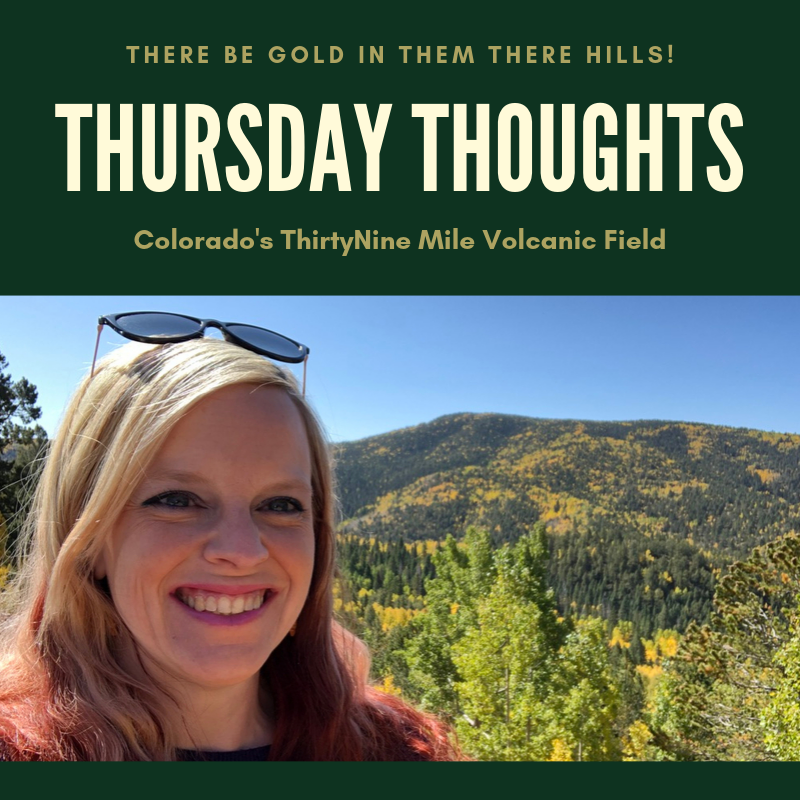
Florissant Fossil Beds: A Window to the Past
A low mist hovered over the calm waters of Lake Florissant. The sun rose higher in the sky, bathing the world in gold light. Shorebirds crooned as they stretched their wings and splashed in the reeds. Fish bobbed to the lake’s surface, snatching water bugs off of the surface for breakfast. An opossum scurried through the underbrush. Redwood trees towered over two hundred feet into the air; their green leaves seemed to scrape the turquoise sky. Steam curled from the volcanic peaks that rimmed the valley. But the early morning calm would be shattered when the earth exploded with volcanic chaos. Thick ash blanketed Lake Florissant and raging lahars finished the job. This eruption—one of many in central Colorado—would create and preserve the monument we now know as Florissant Fossil Beds.
One “Tuff” Hike – The Trail to Wheeler Geologic Area
After discovering that the La Garita eruption – the largest explosive eruption in the history of the Earth – was essentially in my own backyard, I had to explore it. The caldera itself is massive, well over a thousand square miles. It would take me years to explore it all on foot. For now, I decided to focus in on one of the most obvious traces of the ancient eruption: Wheeler Geologic Area.
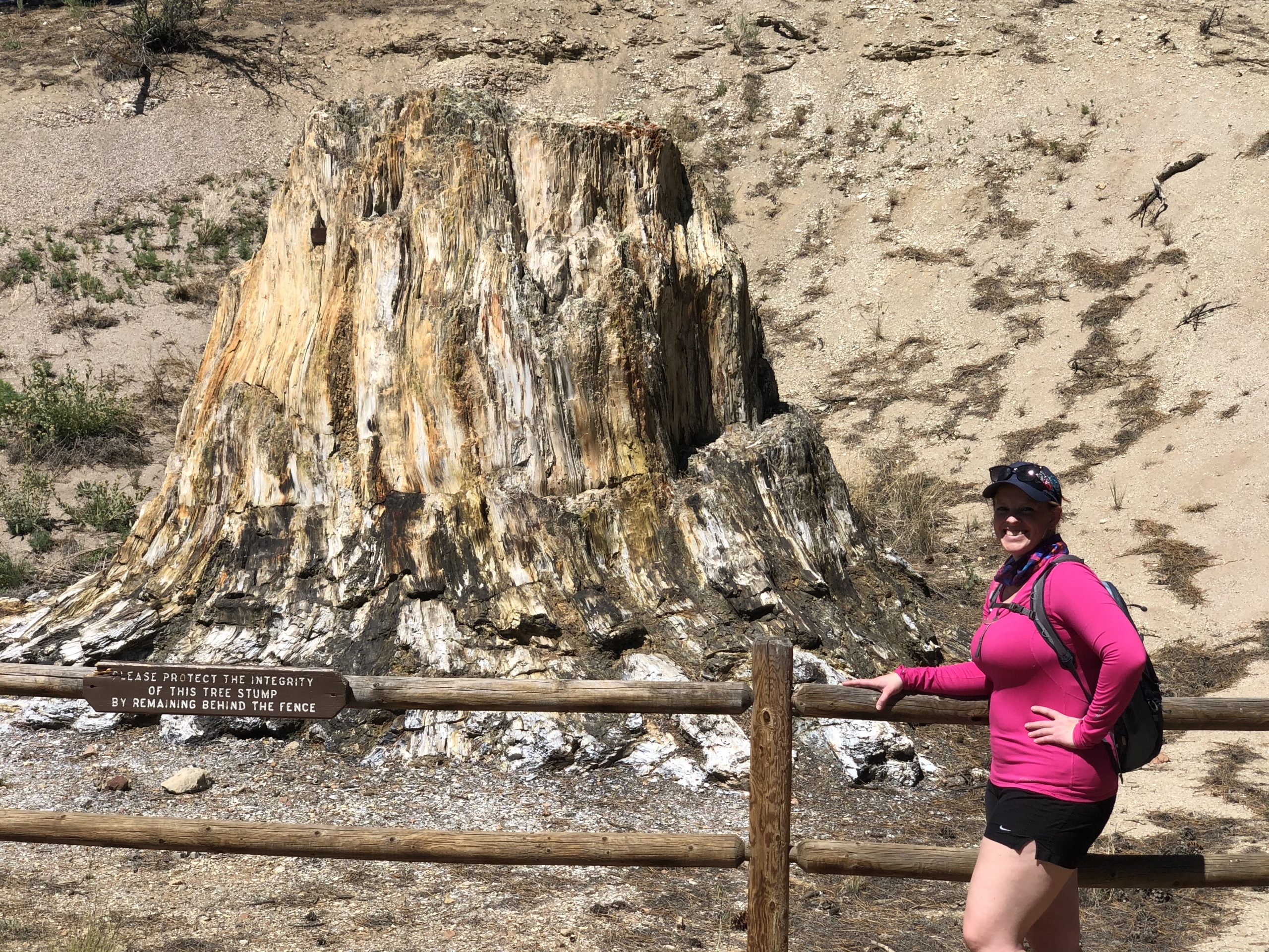
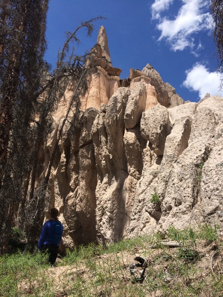
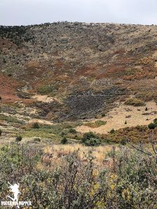
Wheeler Geologic Area is tucked away deep in the La Garita Wilderness in southwestern Colorado. When La Garita erupted, huge amounts of ash and pyroclasts fell out here. The heavy ash compressed together and became volcanic tuff. Now named the Fish Canyon Tuff, Wheeler has been well protected over the millennia by the deep valley where it fell. Erosion has carved away at the tuff deposit over the years, leaving spectacular formations of gray and white behind.
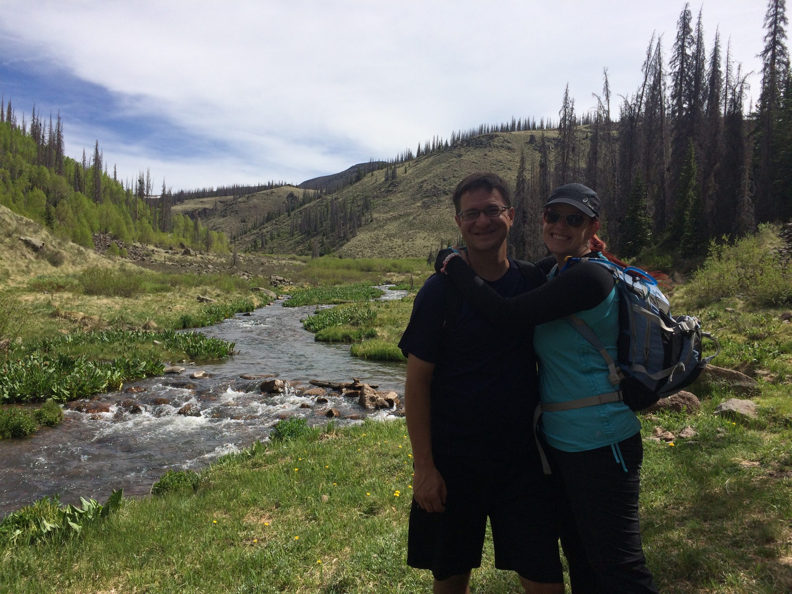
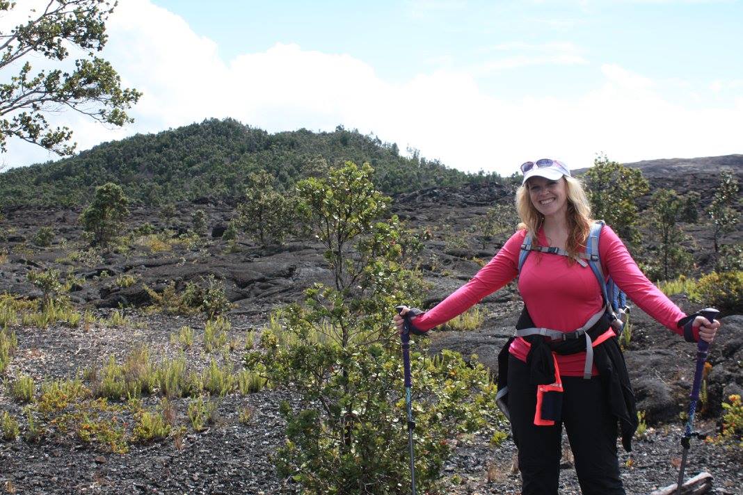
We had tried to plan our adventure to Wheeler Geologic Area for several years after I discovered the existence of La Garita. Monsoon rains and raging wildfires kept us from making the trek until, in 2017, we got our chance. The hike to and from Wheeler Geologic area is a long 8 miles; 16 round trip. But the views and volcanic formations that we saw along the way were absolutely worth it, even if it was one “tuff” hike.
Top 10 Volcanic Eruptions of 2019
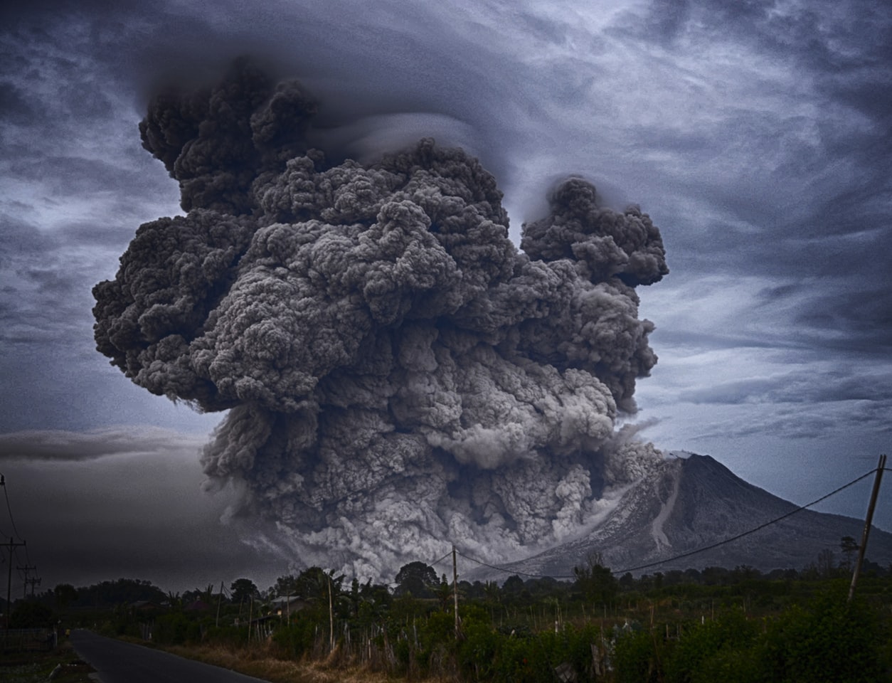
2019 was a dynamic year in many aspects, and the volcanic world did not disappoint. According to the Global Volcanism Program, “There were 73 confirmed eruptions at some point during 2019 from 70 different volcanoes; 30 of those were new eruptions that started during the year.”[1] The earth is always alive with volcanic activity, and an average of 10-20 volcanoes are active and erupting at any given time on our planet. But who were the show stoppers for 2019?
Here are the top 10 volcanic eruptions that left their mark on 2019:
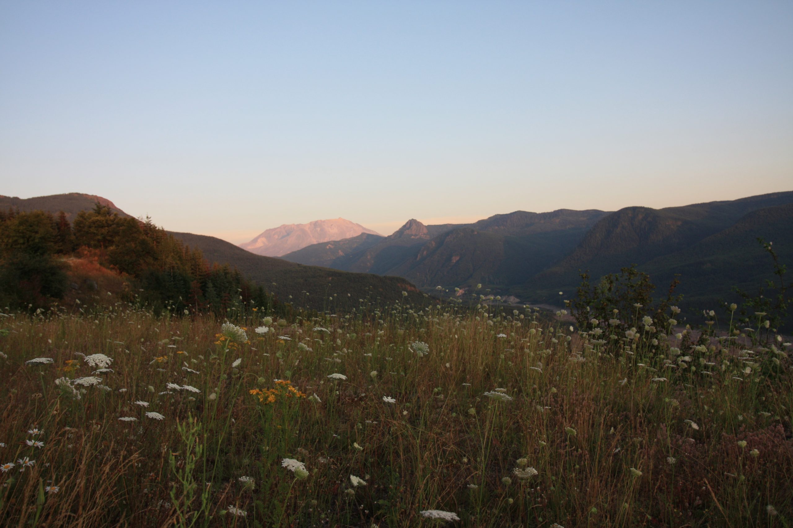
Mount St. Helens: Spirit Lake Memorial Highway to Johnston Ridge Observatory
Visitor Center, Kid Valley & the Forest Learning Center
Mount St. Helens and the Gifford Pinchot National Forest that surrounds her are packed with volcanic features to explore and amazing areas to hike. With so many adventures to be had, where should we even begin? The answer was unanimous: The Spirit Lake Memorial Highway to Johnston Ridge Observatory.
My partner in crime, Jason, and I had met up with my brother and sister-in-law the night before at our cabin on Mount Hood. We snuggled up inside the cabin’s golden timber walls, feeling the crisp mountain breeze blow through the windows as we settled in for the night. Rising with the sun and feeling refreshed after traveling the day before, my sister-in-law, Alex, spoiled us with her fantastic cooking skills, frying up some eggs and toasting fresh bread from a local bakery. Bellies full and a spring in our step, we were ready for adventure!
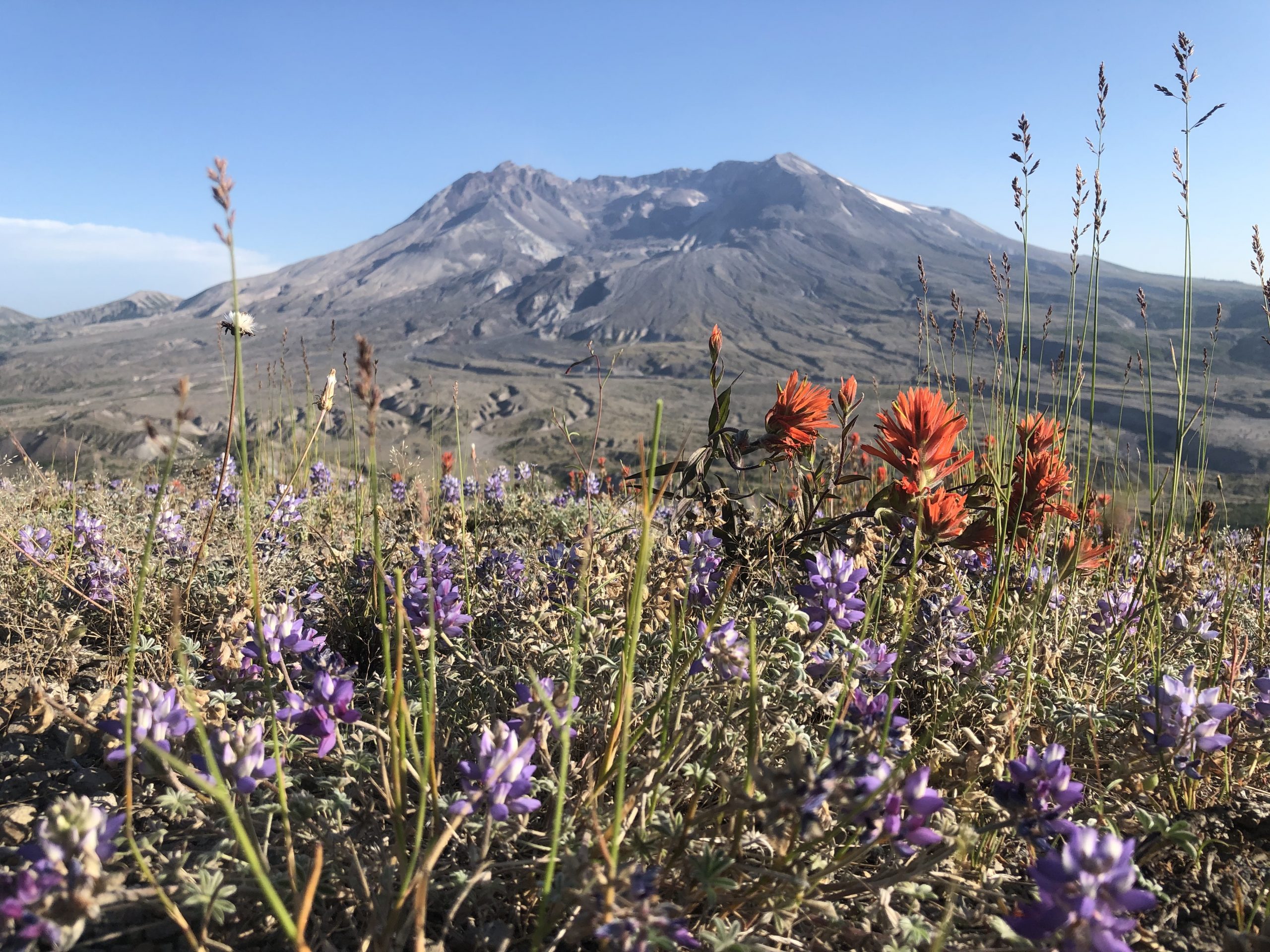
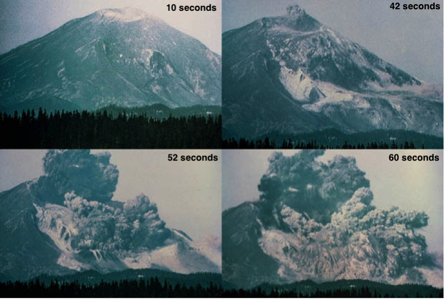
Mount St. Helens – A Trip Through Time
Mount St. Helens. Say her name and it instantly draws to mind images of the cataclysmic eruption of 1980. We all remember the news footage and heart-stopping images of the fiery blast. Americans as far away as Florida had at least a dusting of ash on their cars. Fifty-seven people lost their lives, and the infamous eruption’s impact has lasted to this day. Mount St. Helens has erupted before and since 1980, and has quite the track record to explore. So before we head out on our adventures with the volcano, let’s go on a whirlwind trip through time to get a better understanding of Mount St. Helens.
7 Must-Haves for your Volcanic Adventure
This post is sponsored by Amazon, but all opinions are my own.
So you’re ready to take the leap and are ready to go explore a volcano. But what to bring? Below are 7 must-haves for your volcanic adventure.
If you’ve followed my 5 steps to prepare for a volcano hike (click here if you need a refresher), you should know the volcano you are planning to meet verywell. Knowing the volcano will give you a solid idea of what to bring with you. It is critical to have good gear. I love to find stuff on the bargain rack. I really do! But you have to make sure that the gear you are buying is the right gear for you. It’s no good shelling out the cash for a pack that doesn’t sit right or shoes that pinch your toes. (Trust me – you’ll want to cut your feet off before that hike is over.) Buy the right stuff for YOU the first time around.
One of my marathon coaches once told me, “Nothing new on race day.” Break your gear in early! New clothes/shoes/packs will cause blisters, rashes, and problems out the whazoo. Don’t wait until you’re on the trail to give the gear a trial run.
So, what do you need to bring?
Capulin: The Summit
VITAL STATS
Name: Capulin
Type: Cinder Cone
Eruption Status: Extinct
Last Eruption: Approximately 60,000 years ago
Location: 36.7811° N, 103.9695° W
Northeastern New Mexico; Raton-Clayton Volcanic Field
The clouds that enshrouded Capulin’s cone finally began to break around mid-morning. We raced to the summit to see what had been hidden behind the thick mist all morning. What we found was breathtaking.
Capulin’s summit crater is perched over 1,300 feet above the surrounding plains, and the drive to reach it is nothing short of intimidating. If you’re not driving, take a peek out the passenger side window. There are no guardrails and the view is straight down. This cone has virtually no slope. Not intimidating…not at all…