
VITAL STATS
Name: Capulin
Type: Cinder Cone
Eruption Status: Extinct
Last Eruption: Approximately 60,000 years ago
Location: 36.7811° N, 103.9695° W
Northeastern New Mexico; Raton-Clayton Volcanic Field
We coasted down the volcano road, enjoying our descent from Capulin’s summit. The clouds had finally lifted and myriad volcanoes now popped up from the dusty New Mexican landscape. My partner in crime and I headed in to the Visitor Center for a quick break and a chat with the friendly and knowledgable park rangers. They offered us great information about how Capulin became a national monument in 1916 and how summit road was covertly created in 1925 so that the first Model T’s could putter to the top. Our ranger friends even were able to answer questions about the volcanism of the area. They confirmed that what we spotted on the lava flow trail earlier in the day was indeed andesite – which gave this volcano its explosive past.
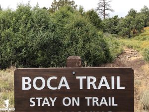
Itching to get back outside and explore the Boca Trail, we drove back to the same parking lot where the Lava Flow trail started. Instead of heading South and sweeping through the volcano’s second lava flow, this trail heads north and winds between the cinder cone and the third lava flow. But here, we found something special. We found the vent from which each of these lava flows emerged.
The Boca Trail is a 2 mile loop trail and is considered to be strenuous. I must confess – I have to hold back a chuckle. This is a walk in the park compared to most other hikes I’ve done, volcanic or not. Still, the trail does get narrow and uneven in places, and some short stretches are a good haul straight uphill. The eroded lava can be a little loose in places, so you want to watch your step. I definitely don’t recommend hiking this in flip flops. Wear sturdy shoes and be sure to take some water along with you. Don’t let the “strenuous” title scare you away.
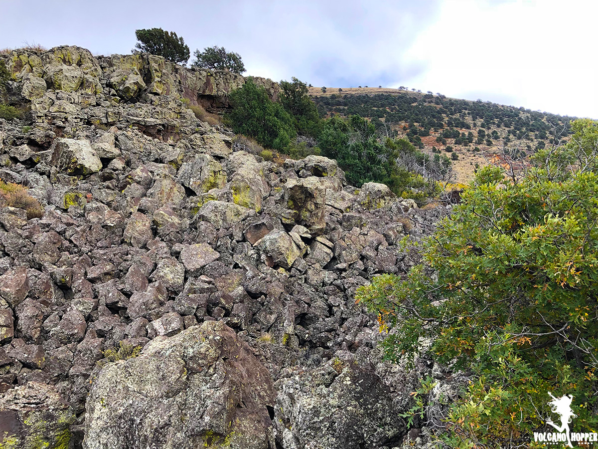
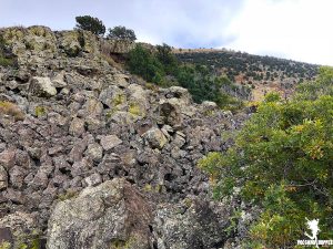
Taking off from the trailhead, we instantly found ourselves in the heart of a lava flow. When the lava was still fluid, its leading edges hardened first. The liquid lava behind the hard edges pushed up behind it, creating pressure ridges. (I describe these more in previous summit post). When we were at the summit we could spot them easily. Here, seeing them from the bottom up, was an entirely new and humbling perspective. Mounds of black basalt towered hundreds of feet above our heads.
We wandered through a forest of pine and scrub oak. Little lizards rustled through the undergrowth and scampered out across the chunks of lava that were strewn everywhere. As my fingertips brushed against the ancient boulders to balance myself along the narrow path, I could still feel the energy that the eruption had created. This place had once been vibrantly alive with volcanic energy, creating the dynamic landscape all around us. Now, quiet and thriving with a different kind of life, the area echoes with songs of the past. If only you stop long enough to listen for it.
The trail pops out of the trees and delivers you to the road. Crossing the highway, the trail instantly begins to mount a golden, grassy knoll. Now we were ascending to the tippy top of the volcano’s third lava flow. Coming to the top, we meandered along the western base of Capulin’s cone. Bright orange scrub oak flooded the fields around us. Colors of the fall trees speckled the volcano’s slopes. Off to our left, a small cinder cone rises out of the flow.
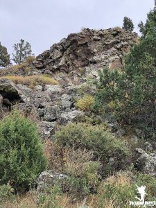
We wound along the volcano’s base until we reached a tremendous wall of lava so tall that Capulin herself barely peeks out from behind it. There is a simple sign that reads “Collapsed Lava Tube.” You can see where lava once gushed through it like water in a pipe, the top half of the “tube” caved in. The lava tube runs further downhill, most of it buried underground. But this place is special. This is the Boca – the mouth of the volcano. This is the vent.
During Capulin’s eruption phase, material blasted from the volcano’s summit vent, creating the gorgeous cone we see today. A second vent erupted later, here at the western edge of the cone, keeping the volcano intact. The basaltic lava flowed from this lower vent and surrounded the mountain’s base. Lava flows from Capulin cover 15.7 square miles and are hundreds of feet thick – even after years of erosion – in places. Can you imagine the volume of lava that came out of here? It’s more than enough to bury a city!
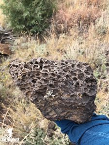
The trail continues north and then loops around to head west and south. As we head further away from the volcano and vent, we are able to examine aspects of the lava flow. The trail is strewn with basaltic rock that is full of holes. The lava was full of gases when it was erupted. As the gases escaped, they tore holes and left pockets in the rock. This makes the rock very light and very fascinating to look at.
As we get to the western edge of the trail, we can look back and see Capulin standing radiantly against the blue sky. Between us and the mountain now is a flat, circular plain filled with golden grasses. This once was a lava lake, similar to what you might see at Erta Ale or formerly on Kilauea. It has long since hardened over and been overgrown with grasses. If you stripped away all the grasses, you possibly could still see the hardened ripples of the surface of the lake.
We curve back toward the volcano. It’s completely quiet out here. We haven’t seen another soul. Until… I turn. There is a small family of mule deer who have been watching us make the trek through the wilderness. We stop; watch each other for a few quiet minutes. They are not afraid. Only curious. Then, they bound off through the trees in search of more lunch.
Coming up over the ridge and skirting the small cinder cone, we arrive back at the highway and return the way we began. A huge lizard romps through the crunchy fall leaves and barrels out right in front of me. He is dark green and black; different from his brown cousins down on the Lava Flow Trail. Here, he is camoflagued in the basalt and pine trees. He realizes he’s been spotted and scampers up a spruce.
So concludes our trip to Capulin Volcano. Exhilerated from our expedition, we begin the long drive home and stop for a couple of cheeseburgers to celebrate.
For more pictures and videos, be sure to hop over to the Facebook page!
Happy Hopping!
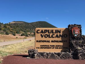
Photo Credit: Volcano Hopper
Copyright © 2019 Volcano Hopper. All rights reserved.

Just a smiling visitant here to share the love (:, btw outstanding pattern.