
Happy International Day of Volcanoes!
Happy International Day of Volcanoes!
So, if we’re getting “technical,” April 10 is the UNOFFICIAL International Day of Volcanoes. But that’s not stopping thousands of people around the world from celebrating the wild and wonderful volcanoes that rock our world.
What’s the big deal about volcanoes anyway?
Volcanoes are freaking awesome! And for more reasons than one:

The Moon is Lava!
VITAL STATS
Name: Earth’s Moon
Eruption Status: Dormant?
Last Eruption: Less than 100,000 years ago
Location: 238,900 miles out in space

Do you remember playing “The Floor is Lava” when you were a kid? If not, you should definitely start a game right now. Wherever you are. It’s a blast! But let’s play a different game today…
The Moon is Lava!
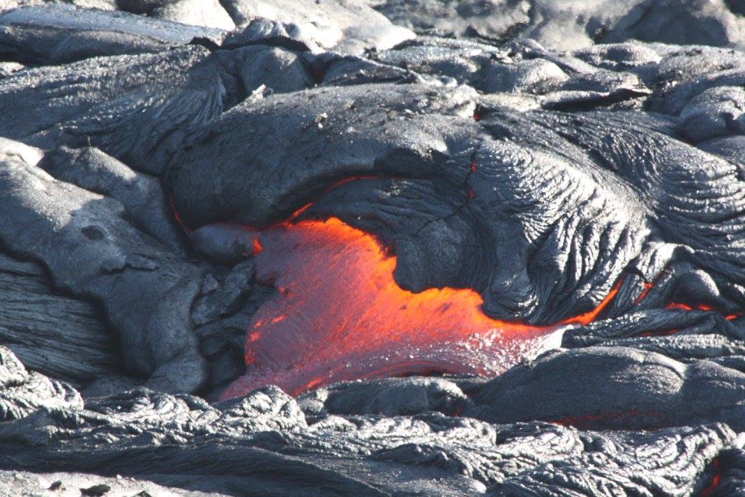
It certainly looked as though this might be the case last Sunday evening during the lunar eclipse. The usual pearly glow of the full moon (a super moon in this case) was replaced by a deep red glow as the Earth blocked the sun’s light. Lunar eclipses like this only happen when the Sun, Earth, and Moon are in a straight line. Earth completely blocks the sunlight from the moon, and what light does refract around the Earth’s atmosphere gives the moon a bloody red appearance. Phew! So that’sall it was? Good. But let me tell you a little secret, my friend. The moon IS lava.
Capulin: The Boca Trail
VITAL STATS
Name: Capulin
Type: Cinder Cone
Eruption Status: Extinct
Last Eruption: Approximately 60,000 years ago
Location: 36.7811° N, 103.9695° W
Northeastern New Mexico; Raton-Clayton Volcanic Field
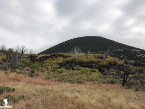
We coasted down the volcano road, enjoying our descent from Capulin’s summit. The clouds had finally lifted and myriad volcanoes now popped up from the dusty New Mexican landscape. My partner in crime and I headed in to the Visitor Center for a quick break and a chat with the friendly and knowledgable park rangers. They offered us great information about how Capulin became a national monument in 1916 and how summit road was covertly created in 1925 so that the first Model T’s could putter to the top. Our ranger friends even were able to answer questions about the volcanism of the area. They confirmed that what we spotted on the lava flow trail earlier in the day was indeed andesite – which gave this volcano its explosive past.
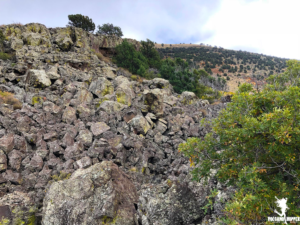
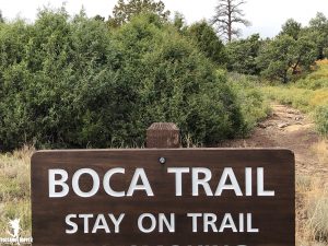
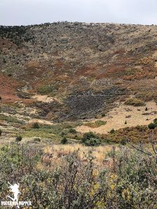
Itching to get back outside and explore the Boca Trail, we drove back to the same parking lot where the Lava Flow trail started. Instead of heading South and sweeping through the volcano’s second lava flow, this trail heads north and winds between the cinder cone and the third lava flow. But here, we found something special. We found the vent from which each of these lava flows emerged.
Capulin: The Summit
VITAL STATS
Name: Capulin
Type: Cinder Cone
Eruption Status: Extinct
Last Eruption: Approximately 60,000 years ago
Location: 36.7811° N, 103.9695° W
Northeastern New Mexico; Raton-Clayton Volcanic Field
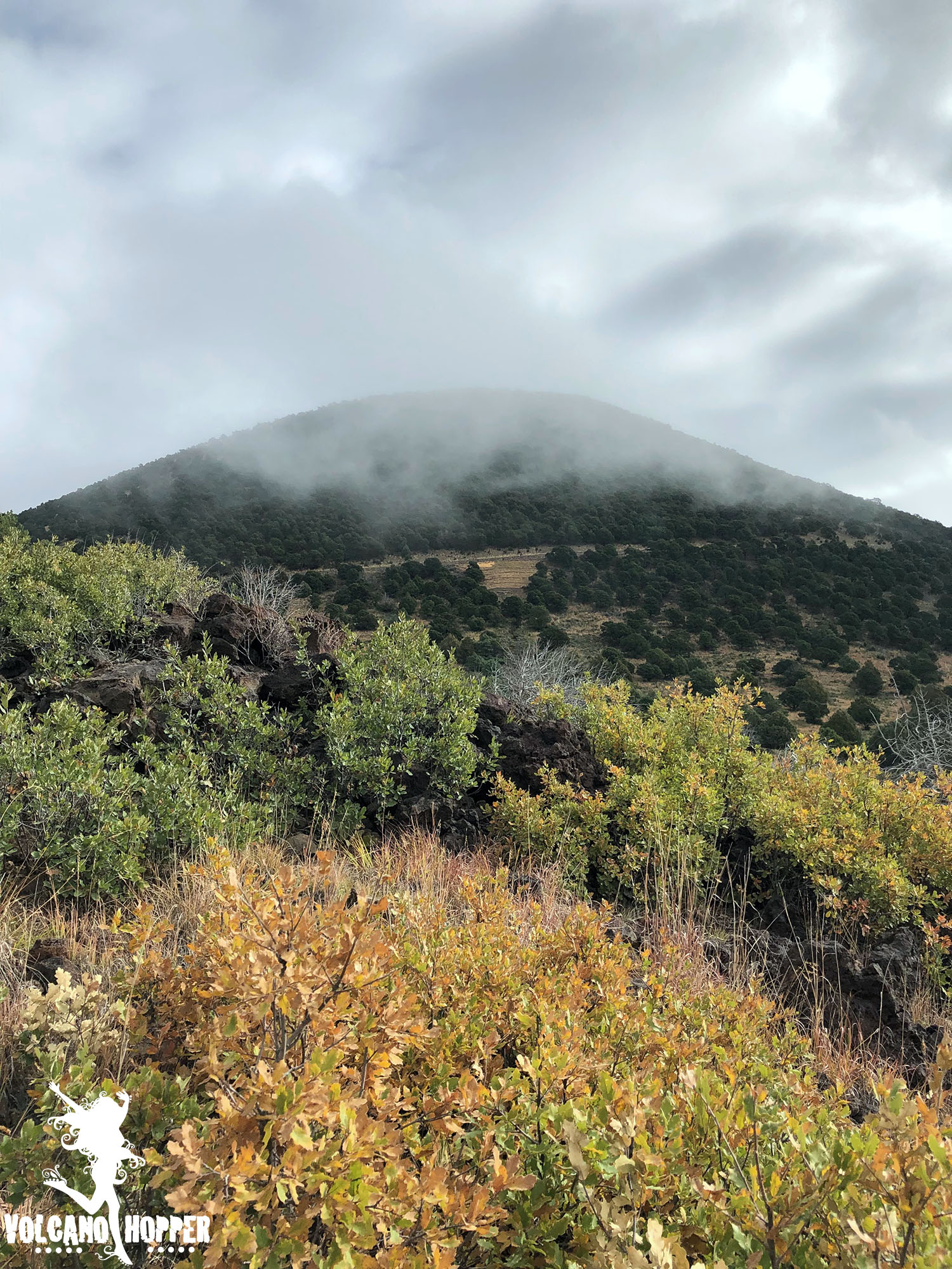
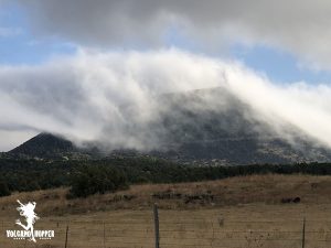
The clouds that enshrouded Capulin’s cone finally began to break around mid-morning. We raced to the summit to see what had been hidden behind the thick mist all morning. What we found was breathtaking.
Capulin’s summit crater is perched over 1,300 feet above the surrounding plains, and the drive to reach it is nothing short of intimidating. If you’re not driving, take a peek out the passenger side window. There are no guardrails and the view is straight down. This cone has virtually no slope. Not intimidating…not at all…
Capulin: The Lava Flow Trail
Vital Stats
Name: Capulin
Type: Cinder Cone
Eruption Status: Extinct
Last Eruption: Approximately 60,000 years ago
Location: 36.7811° N, 103.9695° W
Northeastern New Mexico; Raton-Clayton Volcanic Field
Capulin volcano has 4 lava flows – three of which are absolutely massive. They each started from a vent at the base of the volcano, which has left the stunning cone shape intact. As we waited for the clouds at the summit to lift, we decided to take a hop down the Lava Flow Trail.
This trail is a 1 mile loop through the second lava flow. It only scratches the surface; this flow extends over 2 miles down toward Highway 87! We were anxious to get our boots on the ground and go exploring. So off into the silent, misty morning we went.
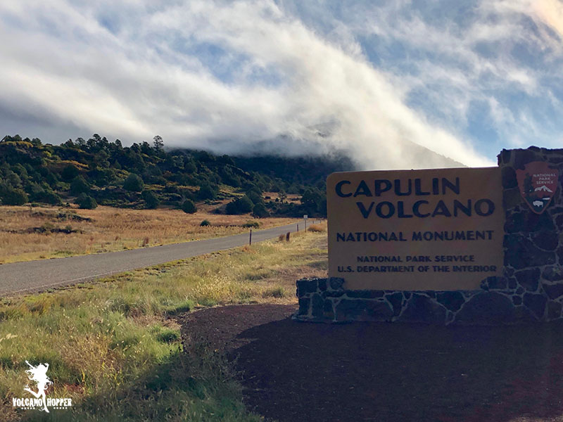
Capulin Volcano
Vital Stats
Name: Capulin
Type: Cinder Cone
Eruption Status: Extinct
Last Eruption: Approximately 60,000 years ago
Location: 36.7811° N, 103.9695° W
Northeastern New Mexico; Raton-Clayton Volcanic Field
The drive east through Northern New Mexico can be a pretty boring one. The landscape is flat and brown, minus a few hills popping up here and there. Major yawn factor – until you see the unmistakable cone of a volcano standing majestically next to the highway. And then you realize exactly what you’re driving through.
The Raton-Clayton Volcanic Field stretches from southern Colorado to the western border of Oklahoma and Texas, near the town of Clayton, NM. This volcanic field is a bit of an anomoly in the volcano world. Most volcanoes form on hot spots (like Hawaii) or along plate boundaries (Cascade Range). New Mexico doesn’t sit on either one. However, a continental rift does run though the area where the land is pulling apart and much thinner than the surrounding crust. This is what allowed magma to rise to the surface, creating some spectacular volcanic activity.
Have adventures, but don’t get injured!
Feeling your knee pop ranks on the list of Top 10 Terrifying Moments, right next to feeling the lava give way beneath your boots, or facing a starving tiger. In that split second after it pops, all sorts of frenzied things race through your mind. “That’s it! I’m done for! I’ll never walk again!”
Lucky for me, I wasn’t 12 miles up a lava field when it happened. I was just standing around, talking story. Yes, I am talented enough to hurt myself while standing still. It takes real skill to do that. But the truth is, this injury was a long time coming.
Yellowstone: Norris Geyser Basin
Vital Stats
Name: Yellowstone
Type: Supervolcano
Eruption Status: Active
Last Eruption: Approximately 640,000 years ago
Location: Black Sand Basin, Biscuit Basin, Midway Geyser Basin, and Lower Geyser Basin
Approx. 44.7262° N, 110.7043° W
Northwestern Wyoming/Southeastern Idaho
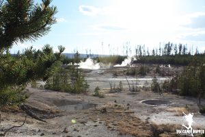
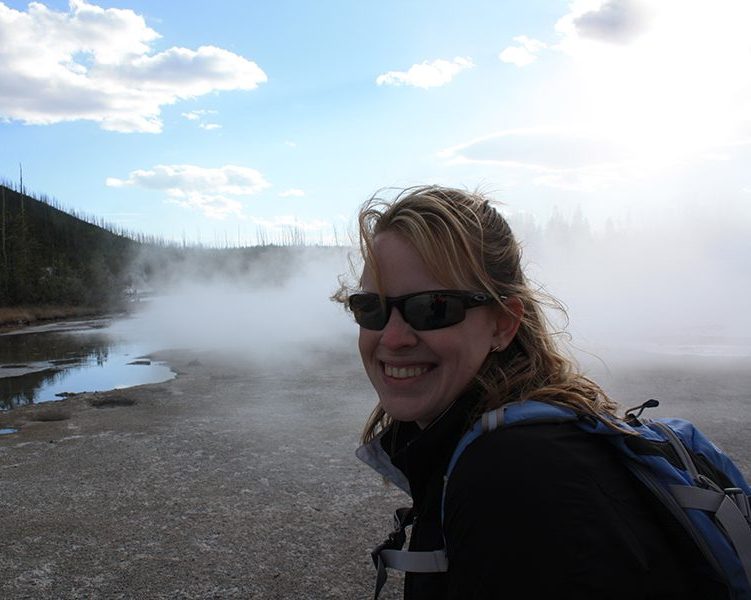
Having a blast with Yellowstone’s geyser eruptions and thermal features? So am I! But we’re just getting started. Now we’re off to the oldest, hottest, and most active geyser basin in the park: Norris Geyser Basin.
Yellowstone: Geyser Basins
Vital Stats
Name: Yellowstone
Type: Supervolcano
Eruption Status: Active
Last Eruption: Approximately 640,000 years ago
Location: Black Sand Basin, Biscuit Basin, Midway Geyser Basin, and Lower Geyser Basin
Approx. 44.4600° N, 110.8292° W
Northwestern Wyoming/Southeastern Idaho
Now that we’ve gotten to see some very impressive geyser action, I’m hooked! I’m stoked to explore the rest of the thermal features in Yellowstone National Park. You too? Well, then, let’s go!
The next stretch of our journey will take us west and north along the southern loop road toward Madison Junction. We will head through four distinct thermal areas: Black Sand Basin, Biscuit Basin, Midway Geyser Basin, and Lower Geyser Basin. Our first stop is only a mile up the road, and I’m ready to explore!
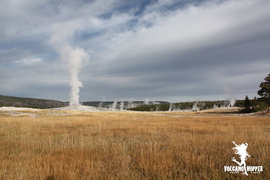
Yellowstone: Upper Geyser Basin
Vital Stats
Name: Yellowstone
Type: Supervolcano
Eruption Status: Active
Last Eruption: Approximately 640,000 years ago
Location: Upper Geyser Basin 44.4600° N, 110.8292° W
Northwestern Wyoming/Southeastern Idaho
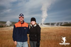
As we head west along the southern loop road, we catch glimpses of wildlife in the thick trees. A mother elk and her calf are grazing on sweet grasses that are clinging to what’s left of autumn. The father, a majestic ten point buck, bounds across the road in front of us and disappears up the hill. As we pass West Thumb Geyser Basin, the trees begin to take on a ghastly appearance. Here you can see the scars of the 1988 forest fires. I was just a kid then, on a cross country trip to Oregon to visit family, but I remember the roiling smoke on the horizon. The fires destroyed 36% of Yellowstone. But forest fires have a natural way of clearing out the old junk and creating space for new life. This is similar to how volcanoes behave. Ash mixes with soil to create fertile land and vibrant life springs forth from it. Now, nearly 30 years later, we can see where life is making her comeback.