
After years of hoping, dreaming, and planning, the morning of August 4 found the four of us driving down the Spirit Lake Memorial Highway in search of mighty Mount St. Helens. My three partners in crime and I had explored the river valleys and Forest Learning Center on our way toward the volcano. But now, the time had finally come for me to meet Mount St. Helens face to face. No more reading, research, or hoping to catch a glimpse out the airplane window. Today I was just a girl, standing in front of a volcano, asking it not to blow me into the stratosphere. At least not until I’d had a thorough chance to explore its slopes!
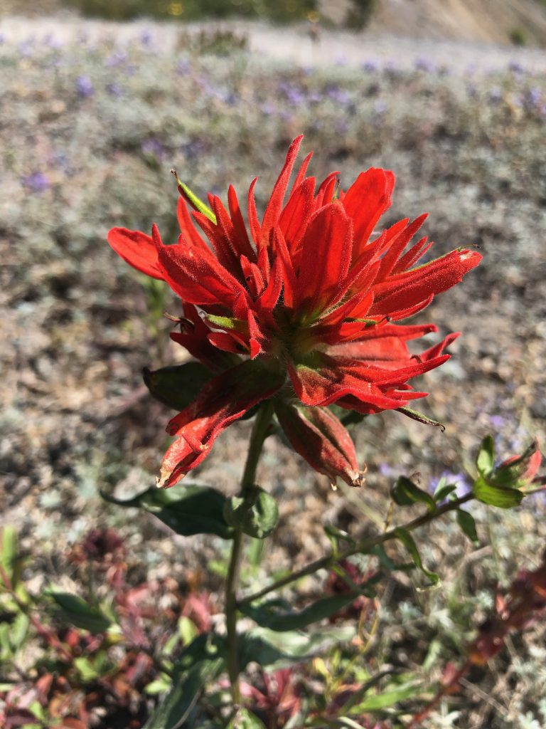
On the first leg of our expedition up the Spirit Lake Memorial Highway, we had only caught fleeting glimpses of Mount St. Helens through the morning mist or peeking out behind the Toutle River Valley’s walls. But now, as Highway 504 looped around and turned south, the road began to wind upward along a series of steep ridges. Then every single tree vanished. Suddenly the tallest thing around were the wildflowers. And maybe those fir saplings over there.
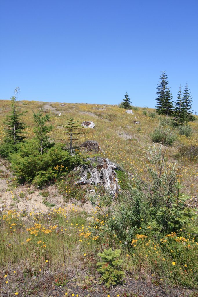
The forest around the Forest Learning Center had been replanted around thirty years ago by Weyerhauser as they tried to restore the forest to its previous glory. But here, inside the Volcanic Monument, everything has been left untouched. Even after 39 years, it is a stark reminder of the volcano’s fury.
We spotted thousands of trees that had been ripped right off of their stumps. In the bright sunshine, they gleamed like bleached matchsticks. All of the trunks lay pointing in the same direction, as if someone had meticulously laid them out in rows pointing from north to south. This shows the direction of the blast from Mount St. Helens, which sits just south of here. On the morning of May 18, 1980 a lateral blast exploded northward from the volcano, leveling an area of forest that reached 20 miles from the volcano.
Studying the steep valley behind a steep ridge, my brother commented on the height of the ridges and hills surrounding this area. “Shouldn’t they have offered some protection from the blast?”
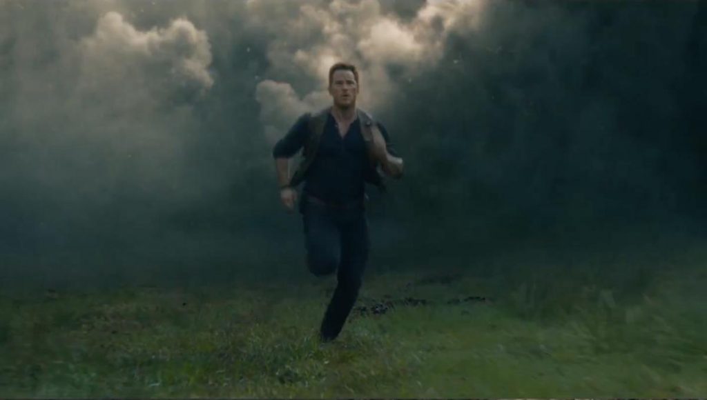
One would certainly think that such a substantial ridge would offer some amount of protection. However, when the landslide triggered the eruption on Mount St. Helens, what erupted from the volcano were pyroclastic density currents (or pyroclastic flows). PDC’s are pretty much roiling rivers of hot gas, ash, and other volcanic materials that the volcano ejects. These currents can race down the volcano at speeds of up to 400 miles per hour and reach temperatures of nearly 2,000 degrees Fahrenheit (1,000 Celsius). There is no way to outrun one. Not even if you’ve got legs like Chris Pratt.
Pyroclastic flows are not easily stopped. The flows typically roar down the path of least resistance. Water will not stop them; they have been known to race right over the surface of lakes and oceans to devour towns and harbors miles away. And in the case of Mount St. Helens, the pyroclastic flows gushed up and over the ridges like ocean waves. It splintered the trees, scraped the hillsides bare, and covered everything in feet of volcanic debris.
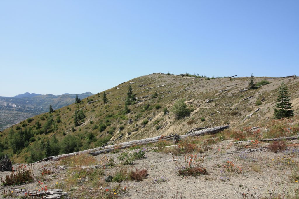
Today, the area is beautiful with the fields of wildflowers and grasses swaying in the breeze. But the scene 39 years ago was far different. 57 people were killed in the blast the morning of May 18, 1980. Survivors describe the landscape we were driving through as hell on earth. The air reeked of sulfur and was so full of ash that a person could not see their friend standing an arm’s length away from them. Ash turns into a wet cement-like mixture as it’s inhaled, clogging the lungs and fine glass shards inside the ash tear up the fragile tissue even further. The air was scorching hot, issuing serious burns to those within the blast zone. Enormous trees littered the ground. Survivors near the volcano had to hike through feet of burning ash to find help.
Knowing many of the survivors’ stories beforehand really put this place into perspective for me. In the Path of Destruction is an excellent read if you want to really dig in and learn the stories of the people who survived the eruption. You can find it here: https://amzn.to/2NjUb1x
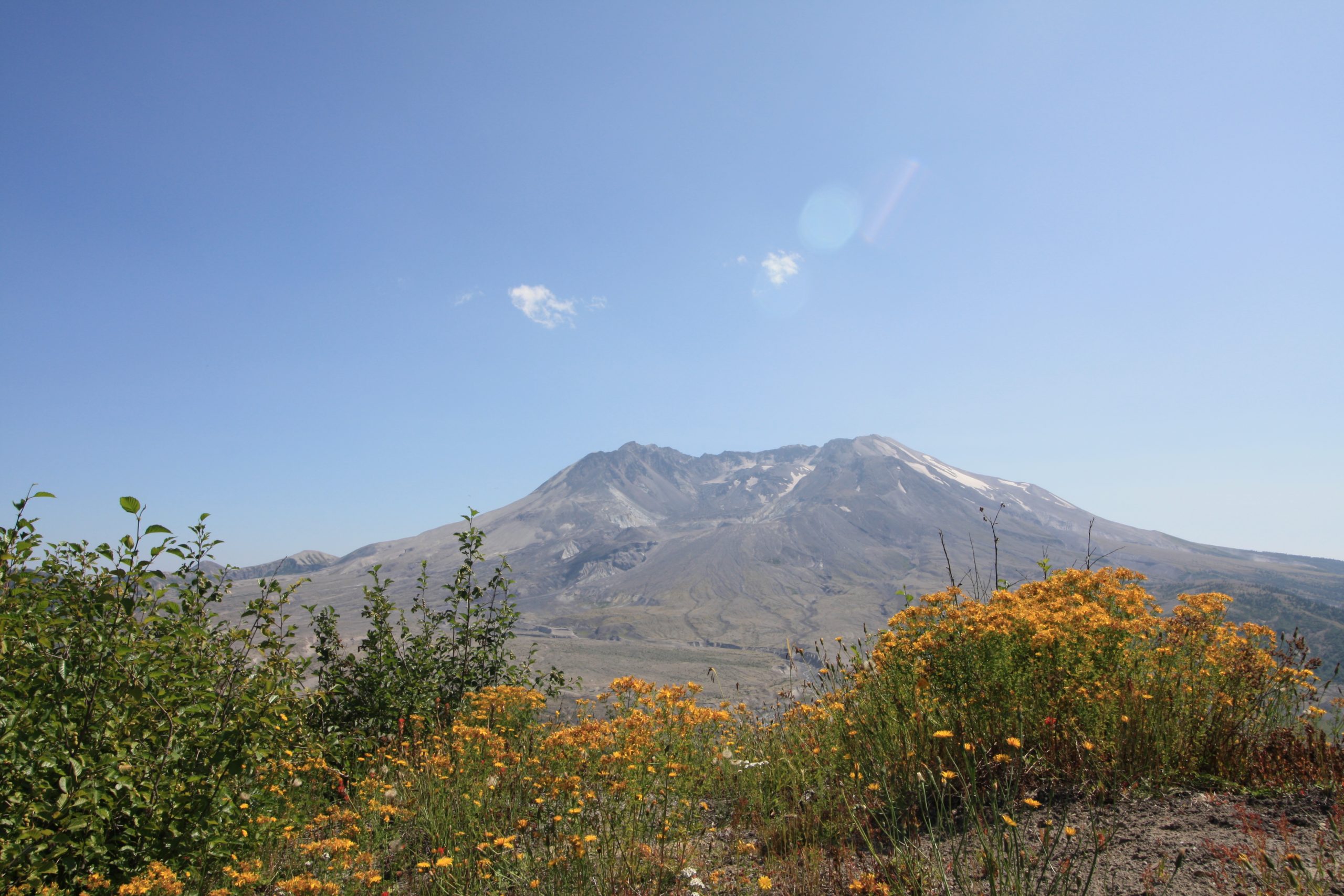
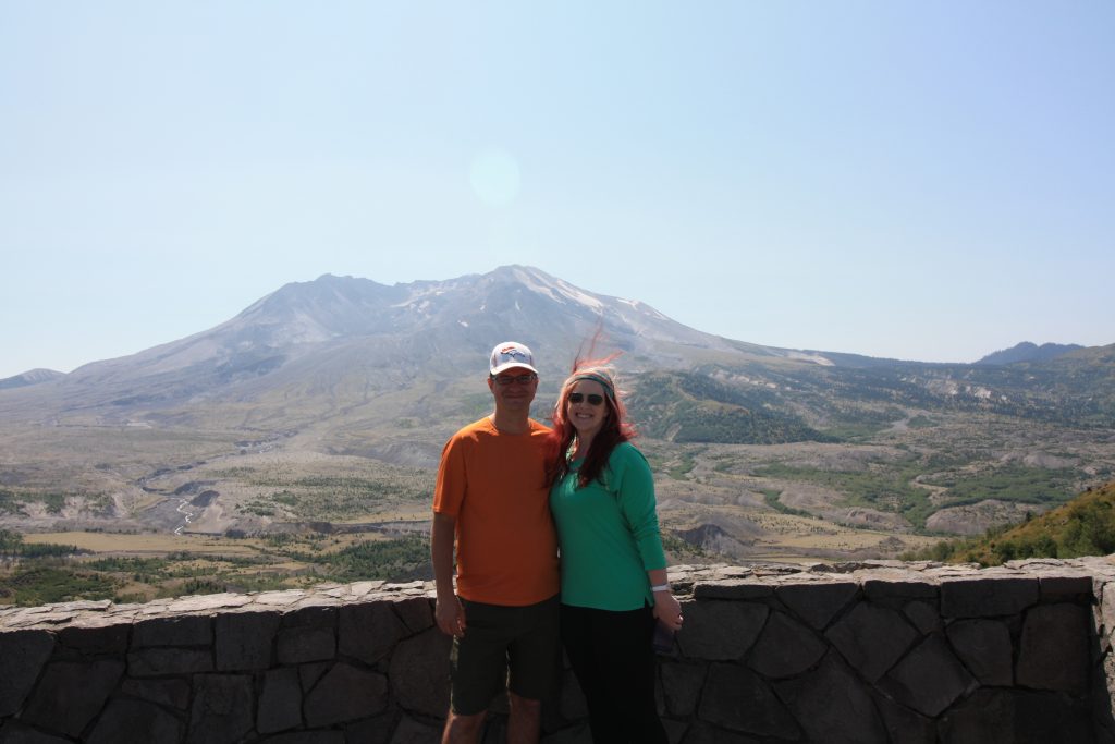
It is still difficult to imagine such a beautiful place covered in so much devastation. I needed to know just what had caused such a thing. As we rounded the hairpin curve, suddenly Mount St. Helens loomed, mighty and majestic, before us.
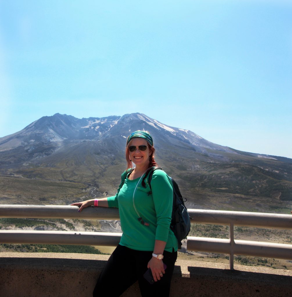
Loowit Viewpoint
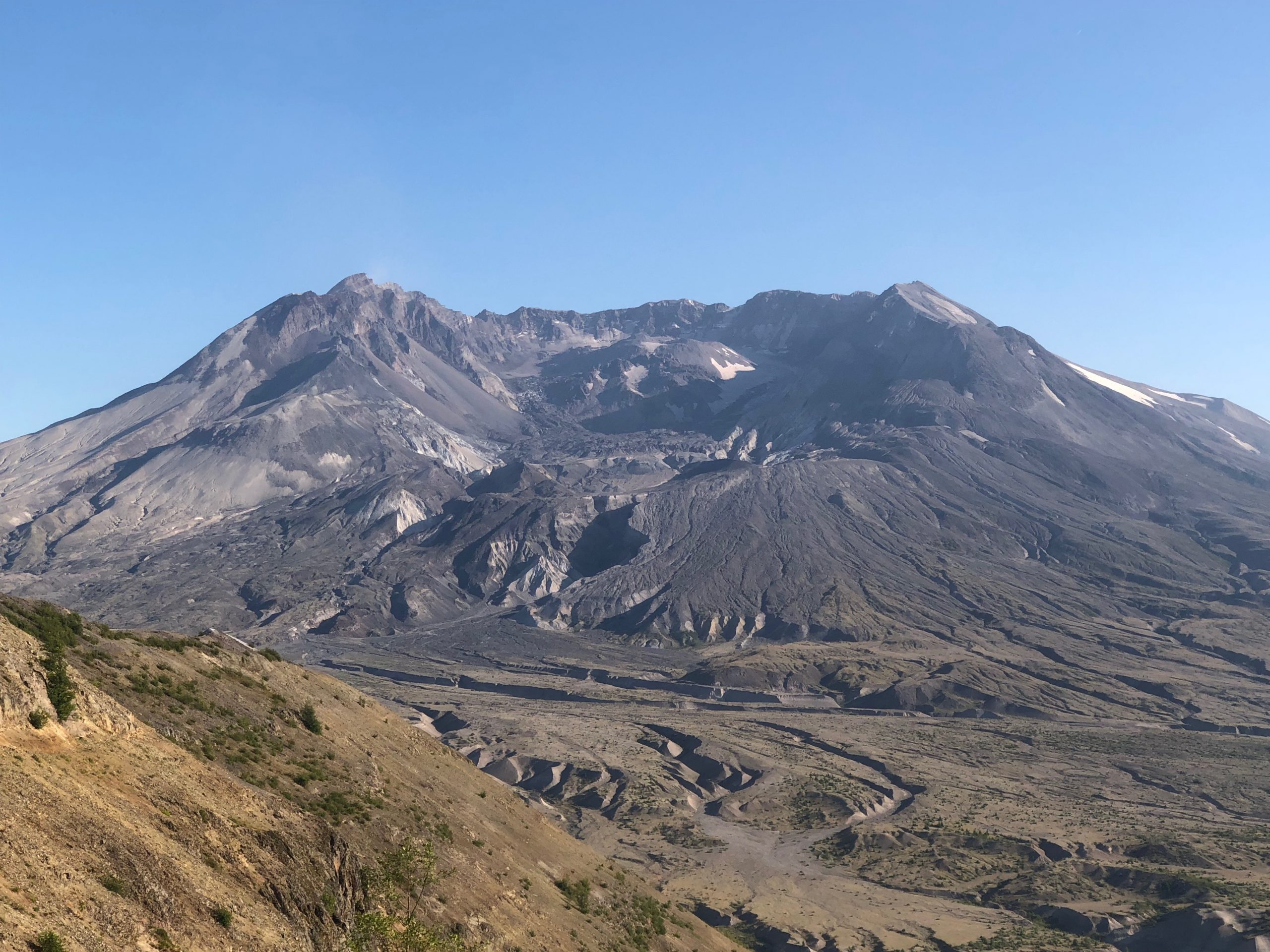
For a full minute, my boots were rooted to the ground. I finally stood face to face with Mount St. Helens and, oh heavens! There are no words to describe how I felt seeing her in person for the very first time. Something in my own core turned molten with admiration, and with very much respect for the volcano the First Peoples had named Loowit. (It suits her, don’t you think?)
Loowit’s gray, ashy slopes caught the sunshine and glaciers glittered like diamonds on her ridges. The north side of the volcano’s bowl-shaped crater lies completely open on the north side, offering a glimpse into the heart of the volcano and its growing lava dome. The sheer size of the volcano, rising above the surrounding pumice plain, is absolutely impressive. Photographs absolutely do not do it any justice.
“We’re going summit that?!” Those were the first words out of my partner in crime’s mouth. You have to remember that all four of us are experienced hikers and have conquered multiple 14er’s in Colorado. You know the volcano must be impressive to spark a reaction like that! Mount St. Helens is steep. She is wild. And just looking at the remnants of the blast zone around us, we knew we were in for the hike of our lives.
David A. Johnston
Here at the Loowit Viewpoint, I took a few minutes to quietly roam the trails along this stretch of the ridge. This place was steeped in memory and meaning. 39 years ago, this place was known as Coldwater II, and it is believed that volcanologist David Johnston was stationed right here the morning of the eruption. He managed a brief radio transmission back to the geological survey as the eruption began. “Vancouver, Vancouver! This is it!” David was killed the morning Mount St. Helens erupted, and his body was never recovered. Only bits of the camping trailer that had been set up as a mobile observatory were ever found.
I did not have the honor of getting to know David, but his work inspired me from a very young age. I wanted to be brave just as he was, and I longed to have the same passion for volcanoes that he did. His work as a scientist was brilliant and paved the way for many other discoveries, and changed the face of volcanology around the world.
David and 56 other people lost their lives the morning of the eruption. The sadness of this loss is still tangible here on the ridge if you pause long enough to feel it and understand it. I took the time to pause and honor the memory of each of them before heading to the last gem on the Spirit Lake Memorial Highway: the Johnston Ridge Observatory.
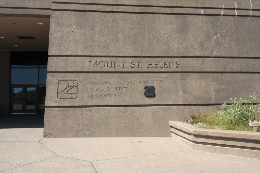
Johnston Ridge Observatory
At the very end of the Spirit Lake Memorial Highway, the Johnston Ridge Observatory sits nestled into the side of the ridge. Coldwater II was renamed Johnston Ridge after the eruption in honor of the volcanologist who lost his life in the eruption. The Observatory itself was built in the mid 1990’s and offers a spectacular view right into the heart of Mount St. Helens only 5 miles away. Sitting at an elevation of 4,314’, the views of the volcano, pumice plain, and surrounding landscape are stirring.
Monument passes are required to visit this area, but they are well worth the few dollars a person that it costs! Inside the concrete observatory building, there is a small gift shop and several interactive displays. Samples of different types of lava (andesite, dacite, rhyolite, etc.) are on display and can be handled. A gigantic model of the Mount St. Helens area, complete with 65,000 multi-colored lights, shows the progression of the 1980 eruption. Seismometers that monitor the volcano in live-time are visible on the wall, along with a key to show what different ‘blips’ on the seismograph mean. Was it an earthquake? A rockfall? Someone jumping up and down next to the instruments? It was fascinating to see the variety of readings right in front of us. Down the hall is a fantastic theater that plays a documentary about Mount St. Helens and her eruptions. The movie has a surprise ending – no spoilers!
Before we ducked back outside into the fresh, mountain air, I dropped a few dollars on a snuggly Mount St. Helens sweater. I would later carry that sweater with me to the summit of the volcano. Every time I curl up inside of its black fleece, I remember the extraordinary hike that I carried it on. But more about that later.
Outside of the observatory is an enormous concrete patio area for observers. During the day, it was extremely crowded with people jostling for pictures. I climbed up the Boundary Trail a few steps away from the crowd to admire the volcano and listen to an interpretive talk in progress. Using the telephoto lens on my camera, I was able to zoom into the volcano’s summit. I could see, through the lens, the tiny form of a person standing on the crater rim. Exactly where we hoped to be in two days!
The four of us opted for a light lunch at the local food truck. This white food truck is the only grub around for miles, so if you venture this far be sure to pack a picnic or be prepared to eat here. The food is pretty basic (and about as expensive as an NFL game) – burgers, hot dogs, pretzels. But it was delicious and fueled us up for the next leg of our adventure. Slathering ourselves with sunscreen and making sure our hydration packs were filled to the brim with water, we put on our hiking shoes and set off down the Boundary Trail toward Harry’s Ridge. We could hardly wait for our trek through the 1980 blast zone. Who knew what we’d discover?
Next Up: Johnston Ridge Observatory to Harry’s Ridge
Copyright © 2019 Volcano Hopper. All rights reserved.
Loved this post? Share it!
I too love this place. I climbed Her in May of 2017, made it close to the top, bad weather on top. Thanks for sharing your experience and passion.
Hi Melanie! I’m glad you had the chance to climb her – sorry the weather turned out to be nasty. It’s amazing how fast it can change up there. Do you think you’ll try to climb the volcano again? Thanks for your note – happy to have you on our adventures with us!