
A low mist hovered over the calm waters of Lake Florissant. The sun rose higher in the sky, bathing the world in gold light. Shorebirds crooned as they stretched their wings and splashed in the reeds. Fish bobbed to the lake’s surface, snatching water bugs off of the surface for breakfast. An opossum scurried through the underbrush. Redwood trees towered over two hundred feet into the air; their green leaves seemed to scrape the turquoise sky. Steam curled from the volcanic peaks that rimmed the valley. But the early morning calm would be shattered when the earth exploded with volcanic chaos. Thick ash blanketed Lake Florissant and raging lahars finished the job. This eruption—one of many in central Colorado—would create and preserve the monument we now know as Florissant Fossil Beds.
Colorado’s Rich Volcanic History
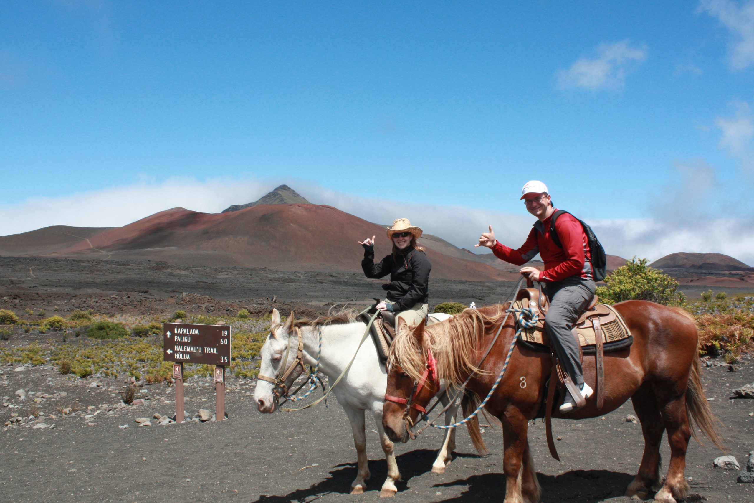
Coronavirus may have squashed our travel plans for 2020, but it didn’t squash the wanderlust burning in my soul. My partner in crime and I decided to hop in the car and explore some volcanoes in our backyard.
When I say “Colorado,” I’m betting that volcanoes are not the first thing that pops into your mind. You might be imaging snowcapped Rocky Mountains, bears and mountain lions, bustling cities or sprawling ranches. But volcanoes? We were taught that there were no volcanoes in Colorado when I was in grade school. Imagine my surprise when, as an adult, I discovered a vastly different truth. Only one volcano in the state is still considered active, but the remnants of Earth’s biggest eruptions can be found here. Other volcanic treasures are hidden in plain sight. One just has to know where to look.
Finding Florissant
An hour west of the city of Colorado Springs sits the hundred-person town of Florissant. If you blink, you might miss it. The town is home to the Colorado Wolf and Wildlife Center and the Pikes Peak Historical Society. A few miles outside of town, there are excellent places to camp, fish, and hike. We had come here for an unexpected glimpse into the past at Florissant Fossil Beds National Monument.
Turning off of Highway 24, we cut through the rolling countryside on County Road (CR) 42, then turned north onto CR 1. An alternate way into Florissant Fossil Beds is to turn south directly onto CR1 from Highway 24. The only difference is which way you enter the monument—from the north or the south.
We had tried to beat the forecasted 100-degree weather by getting an early start. The sun was just rising over Pikes Peak and the Front Range as we parked the car in a small lot near Florissant Fossil Beds’ Hornbek Homestead. The patches of forest cast long shadows in the gold light and the grasses and wildflowers waved in the breeze.
Hornbek Homestead
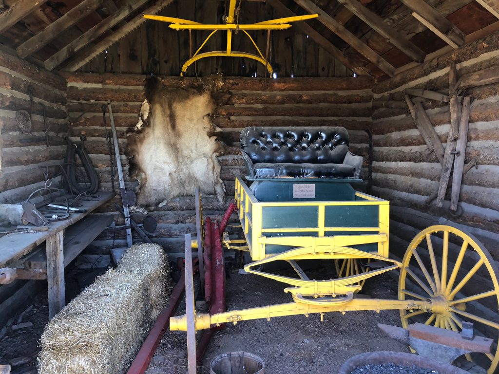
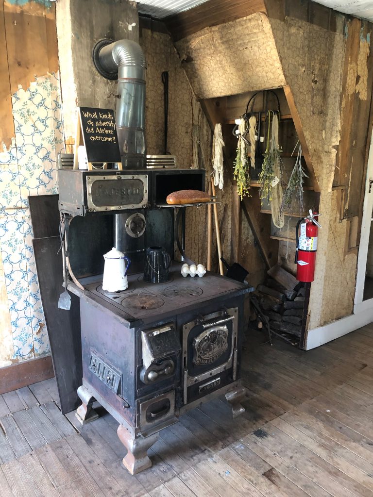
As we stretched our legs from the car ride and got our bearings, we investigated an old nineteenth-century homestead a hundred yards off the road. Called the Hornbek Homestead, the two-story shanty was built in 1878 by Adeline Hornbek, a single mother of four who was the first person to file a homestead claim in the valley. It was the first home to have a second story in the region and was decorated in Victorian-style furnishings. The homestead is complete with the house, carriage house, and stables. Visitors can still walk through the inside of the house and peek inside the exterior buildings to get a feel for what life was like for homesteaders and settlers at the turn of the 20th century. You can read more about Adeline’s story here.
A Brief History of the Valley
The valley around Florissant has a rich human history. The Ute Nation first settled the area and used it for their hunting and gathering grounds each year. In the late 1800s, the town of Florissant was established by James Castello and began to draw other settlers to the area. By the 1870s, word of the fossils near Florissant had gotten out and scientists began to travel to the area. By the 1920’s the area had become a tourist stop and the area had been cordoned off into two private endeavors: Colorado Petrified Forest and Pike Petrified Forest.
In the 1960’s Florissant valley drew the attention of homebuilders. Plans were drawn up to create housing developments where Lake Florissant once stood. However, this would have uprooted and destroyed the petrified redwoods and fossils buried in the area. After petitioning the United States’ Department of the Interior three times, with just weeks to spare before ground was broken, the area was made into a national monument in 1969.
A Tuff Hike
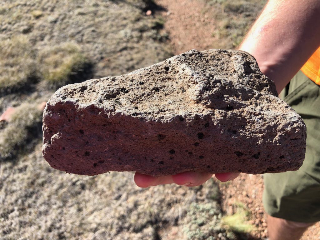
Slathering on the sunscreen and grabbing our backpacks, we headed east along the Hornbek Trail. The path crosses CR1 from the homestead and climbs a grassy slope covered in red Indian paintbrush and blue flax blooms. As we trekked higher up the ridge, we began to spot evidence of volcanic activity. Gray and tan chunks of volcanic material packed with andesite and rhyolite—some as large as a basketball—stood out among the foliage. The composition of these lava chunks was evidence of the area’s explosive history.
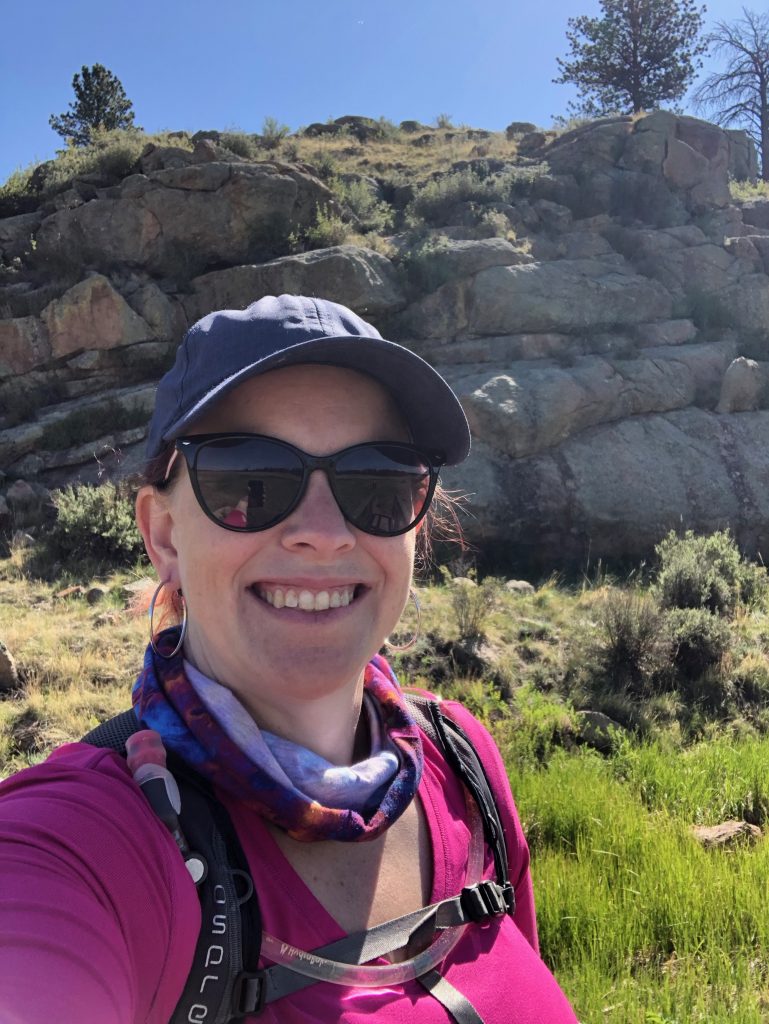
We reached a junction in the trail and turned right, proceeding into a pine forest toward the monument’s Geologic Trail. The trail turned steeply up as we climbed to the top of a ridge. We came out the other side and, as the Hornbek Trail intersected with the Geologic Trail, the trees receded to offer us a stunning view of the valley below.
Several volcanoes are visible from the top of this ridge: Mount Pisgah to the south, and the remnants of the Guffey Volcanic Complex to the west. The extinct Guffey Volcanic Complex sits only a few miles west of the Florissant valley and was the source of many pyroclastic flows and lahars that reshaped the valley. It is believed that enormous stratovolcanoes—similar to Mount St. Helens and Mount Hood—once towered over central Colorado. The remnants of these volcanoes and the intense activity are still visible today near the town of Guffey.
As we observed the volcanoes in the distance and the sprawling valley below, it left no doubt that the ridge where we stood had been created by volcanic forces. But which forces? And what exactly was beneath our boots?
Wall Mountain Tuff
The entire ridge along the east side of the fossil beds was formed by a massive deposit of tuff. Tuff is created when an eruption creates a heavy fall of ash or pyroclasts. The weight of the deposit plus the presence of water turns it into a concrete-like mixture. When it hardens, it leaves solid rock behind. Other examples of tuff formations include Wheeler Geologic Area in southwestern Colorado and Smith Rock State Park in Oregon.
The Wall Mountain Tuff was created thousands of years ago when an explosive eruption near Mount Princeton, only 50 miles west of Florissant, ejected an enormous pyroclastic flow. The eruption was 1,000 times greater than the 1980 eruption of Mount St. Helens. The pyroclasts and ash from this eruption settled in the Florissant Valley and surrounding areas, creating the Wall Mountain Tuff. Some of the ash spread as far as the town of Castle Rock. The large rock formation that caps the top of a mesa in the town—known as Castle Rock Rhyolite—is created by Wall Mountain Tuff.
Looking down into the valley spread below us, we take a moment to ponder the scale of that eruption and what it must have done to this valley and its ecosystem. It must have been sheer devastation. How had those eruptions from the Guffey Volcanic Complex and the caldera near Mt. Princeton shaped this region? How had the volcanic activity created Lake Florissant on the valley floor below us and then removed it? And what secrets had it left buried for scientists and explorers to find today? We were eager to find out.
Lake Florissant
We climbed down the steep ridge and, coming around a bend, discovered layers of Wall Mountain Tuff that are exposed on the hillside. As we reached the valley floor and looked back, we had a much better appreciation of how much ash and pyroclastic deposits it had taken to create that tuff ridge.
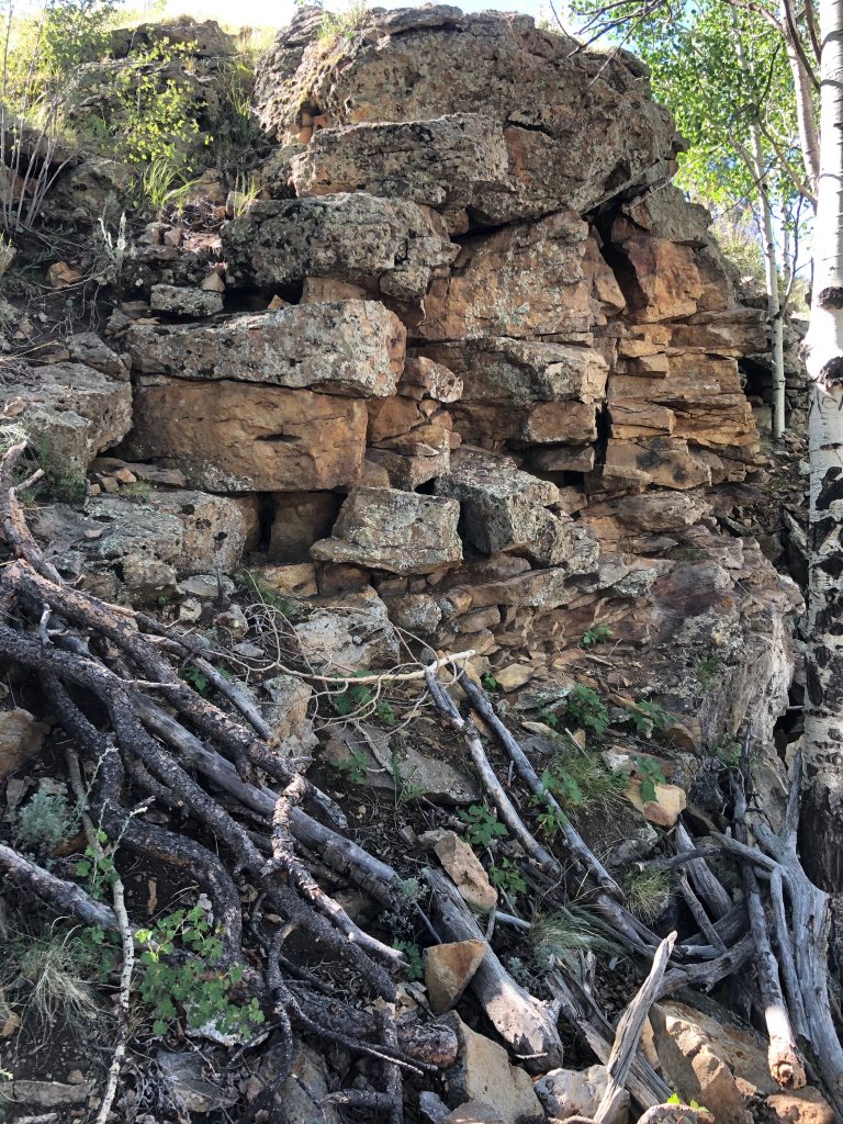
The trail crossed over a bubbling stream and CR1, heading toward the visitor center and old lakebed. This area, however, hadn’t always been a lake. A volcanic eruption from the Guffey Volcanic Complex sent volcanic debris tumbling into the valley and it blocked the streams. The new volcanic dam created Lake Florissant and life began to thrive in the new lakeside environment. All of it was destroyed when several major volcanic eruptions blanketed the area in ash, pyroclasts, and thick lahars.
But they left behind a beautifully preserved bed of fossils and petrified forest for us to discover. The eruptions allowed us to glimpse through a window into the past and discover a few surprises. Besides, looking at Colorado’s dry and dusty summer heat, who would ever have imagined that Colorado would have once had a flourishing sub-tropical climate?
Giant Redwoods
If you’ve ever visited California and seen a redwood tree, then you know just how huge they can be! It would take many people, linked hand in hand, to surround the trunk of one of these trees. Redwoods can grow to a height of 250 feet and have a diameter of 20 feet. However, these aren’t trees that you’d expect to see in Colorado’s current arid climate—and certainly not trees this big!
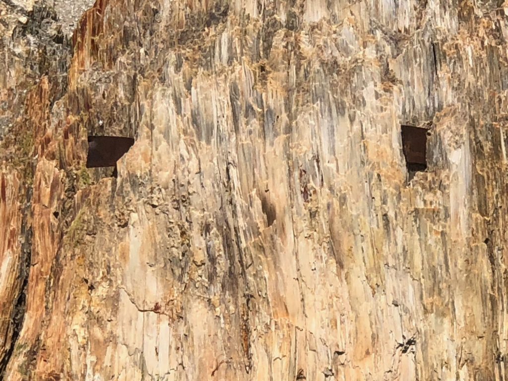
We hiked to the visitor center to check out the giant redwood stumps. These redwood stumps were petrified and preserved when a fifteen-foot deep lahar buried them. The rest of the tree died and decayed. The base of the tree, however, was encased in the mud and was converted to rock during the petrification process.
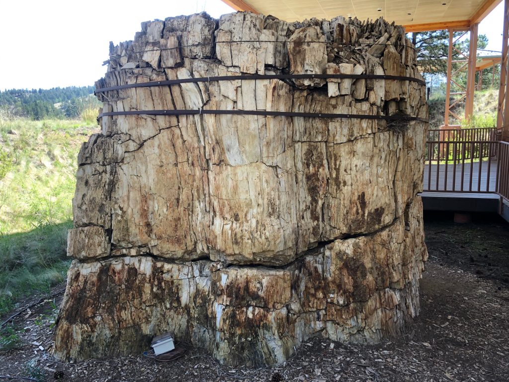
Today, protective structures surround the petrified redwood stumps to protect them from the elements. Weather equipment constantly monitors the conditions around the redwoods while steel bands surround their exteriors. These measures prevent the trunks’ deterioration now that they have been unearthed.
Walt Disney paid a visit to Florissant in July 1956. The petrified redwoods in the valley fascinated Disney. He purchased a five-ton tree stump that is 7.5 feet in diameter. The tree was estimated to have stood 200 feet tall before it was buried by the lahar. Disney had the tree stump shipped to California where he and his wife presented it to Disneyland in 1957. Disneyland still showcases the petrified tree stump today.
Petrified Forest Loop
We stopped under the shade of the canopies covering the redwoods to beat the summer heat for a bit and talked story with two of Florissant’s amazing rangers, Nick and Jeff. Both rangers are an amazing wealth of knowledge about the geologic history of Central Colorado and they were eager to share that knowledge with us. They showed us samples of fossils and casts of animal jaws discovered in the fossil beds. You can check out some of the fossils that we got to see here. With a better understanding of the area under our belts, we set off on a short hike around Florissant Fossil Beds’ petrified forest loop.
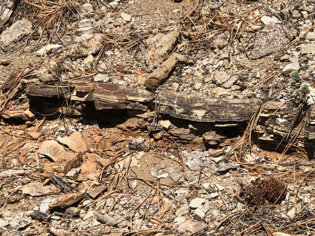
This trail winds along the shore of the old lake bed. Old lahars are still visible, covered by trees, grasses, and other foliage. Only a short distance from the redwoods at the visitor center, we came across an eroded lahar with layers of shale visible in its depths. These shale layers are home to most of Florissant’s fossils—plants, mammals, fish, birds, and insects. The trail passes a handful of enormous, unearthed redwood tree trunks. Big Stump is the largest of them all.
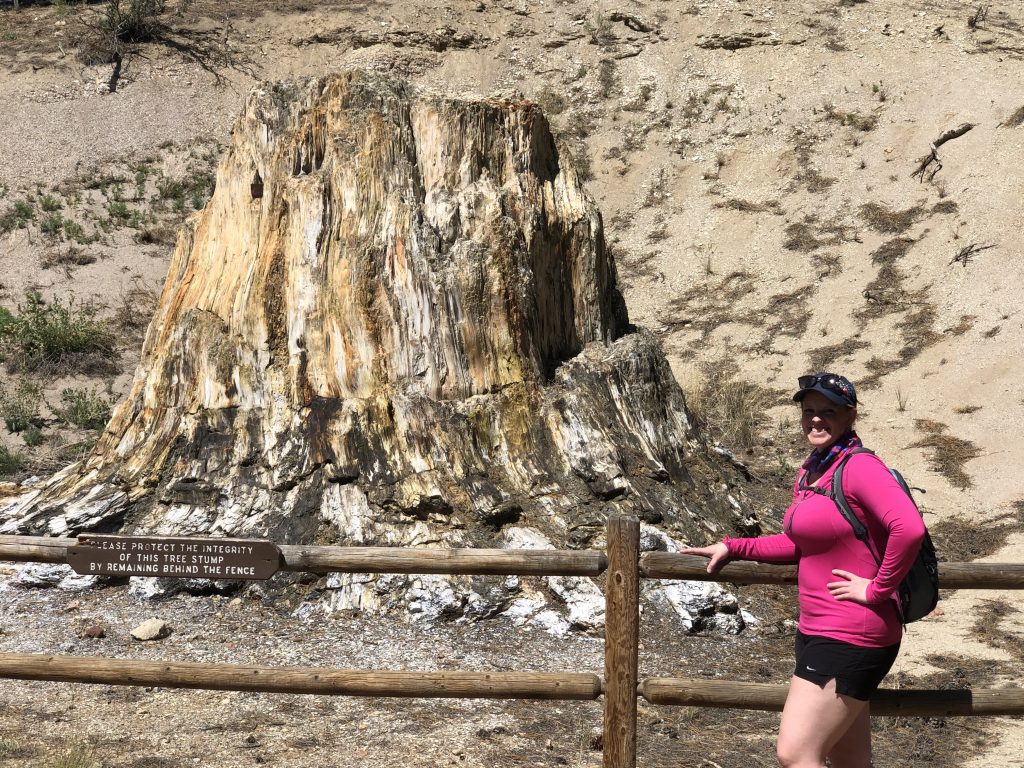
Big Stump sits at the base of an enormous lahar. A mudflow forms the base of the hill, followed by a layer of shale, and then caprock (which is more mud). The lahar buried Big Stump when the tree was around 750 years old. Before Florissant Fossil Beds became a national monument, there were several attempts to cut down Big Stump. None succeeded because the stump is now more rock than organic matter. A broken and rusted saw blade is still lodged in the side of the petrified tree.
Western Hornbek Trail
Leaving the visitor center and cluster of redwoods, the Hornbek Trail continues along the western edge of the old lakebed and winds around to the Hornbek Homestead. The trail winds through old lahars and a marshy wetland. The horseflies were relentless (so bring a can of bug spray!) but the birds that were crooning by the creek were beautiful. The route offered fantastic views of the old lakebed and the volcanic deposits surrounding the area.
The trail ends at the Hornbek Homestead where we had started our journey. Ranger Nick had come up to the homestead while we were hiking, so we stopped to investigate the house, carriage house, and stables for a few minutes before we hopped in the car to go investigate the volcanoes that had a hand in creating these amazing fossil beds.
Guffey Volcanic Complex
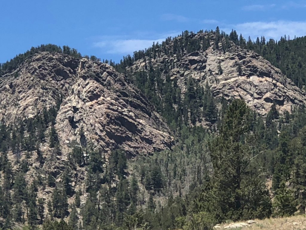
We hopped into the car and headed west on Highway 24 in search of the Guffey Volcanic Complex. The red Pikes Peak granite gave way to the blacks and grays of lava on the towering mountains. Thirty-Nine Mile Mountain, Castle Mountain, McIntyre Mountain, and Witcher Mountain—which all sit outside of the town of Guffey—are all old volcanic remnants of the enormous stratovolcanoes that scientists believe once filled this area.
We stopped at Wilkerson Pass where the road winds down onto the valley floor and heads west as far as the eye can see. In the distance, the snowcapped peak of Mount Princeton and the other Collegiate Peaks glistened like diamonds in the afternoon sunshine. A look back in the direction we had come offered views of the area’s volcanoes and Pikes Peak in the distance. We ached to explore the four remaining peaks in the Guffey area, but hiking 7 miles in the day’s almost 100-degree heat had sapped our energy. We were ready for some cold drinks and hot food.
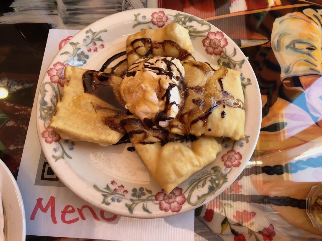
The two of us stopped at Fiesta Mexicana in Woodland Park, Colorado for some of the best Mexican food in the state. Their dining room had just reopened after the coronavirus closures and we snagged the last available table. We relished the first dinner in a restaurant that we’d shared since January. After a long hike at Florissant Fossil Beds, nothing tasted as good as a Coca-Cola, those chile-smothered burritos, and honey-glazed sopapillas.
My wanderlust had temporarily been sated, but not for long. Luckily, Colorado holds plenty of other volcanic treasures to unearth and I can’t wait for our next adventure.
Feeling some wanderlust yourself but can’t travel because of the Covid-19 restrictions? Take a virtual tour of Florissant Fossil Beds here!