
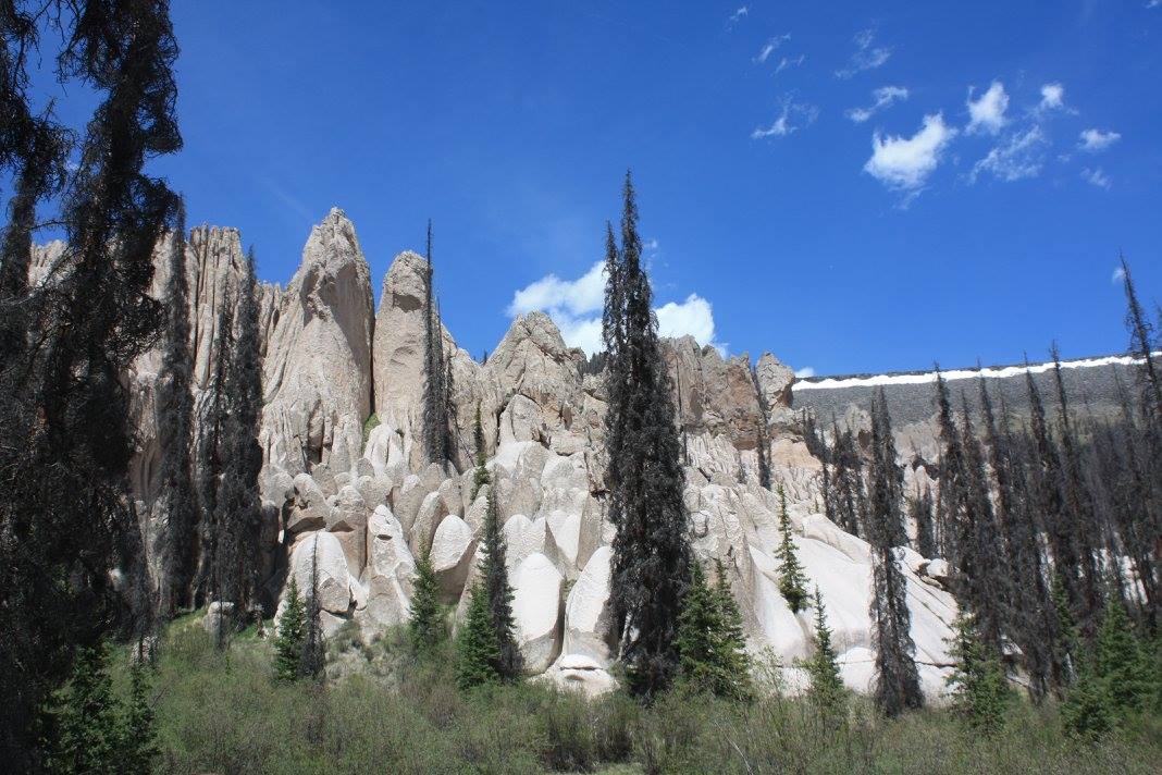
La Garita: History’s Most Epic Eruption
As a kid, I wanted nothing more than to have a volcano or two within exploring distance. Given that I was 8 years old and couldn’t drive, that distance was about five miles. My friends and I used to make up stories that the nearby mountains were volcanoes and could erupt at any moment just to sate our sense of adventure. As far as we knew, the only volcanoes in the United States were Yellowstone, in Hawaii, or along the West Coast. The rest of the world’s volcanoes were in far off, exotic places like Japan or Iceland. Little did we know that real volcanoes were closer to home than we ever imagined – including the most explosive and epic eruption in Earth’s history: La Garita.
The San Juan Volcanic Field
La Garita Caldera sits in the middle of Colorado’s San Juan Volcanic Field. Located in the southwestern part of the state, the volcanic field was once extremely active. Two continental plates once collided here and caused the ground to fracture and faults to form. These faults allowed heated magma from the Earth’s mantle to rise and pool in massive magma chambers beneath the crust. The results were often explosive.
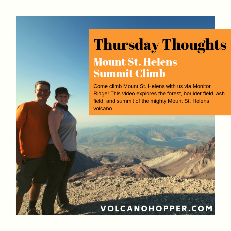
Thursday Thoughts – Climbing Mount St. Helens
Climbing Mount St. Helens was one of the most difficult, and most rewarding, hikes I have ever done. There is nothing quite like the thrill of reaching the top of an active volcano!
Mount St. Helens: Sweet Summit Success!
Monitor Ridge – Part 2
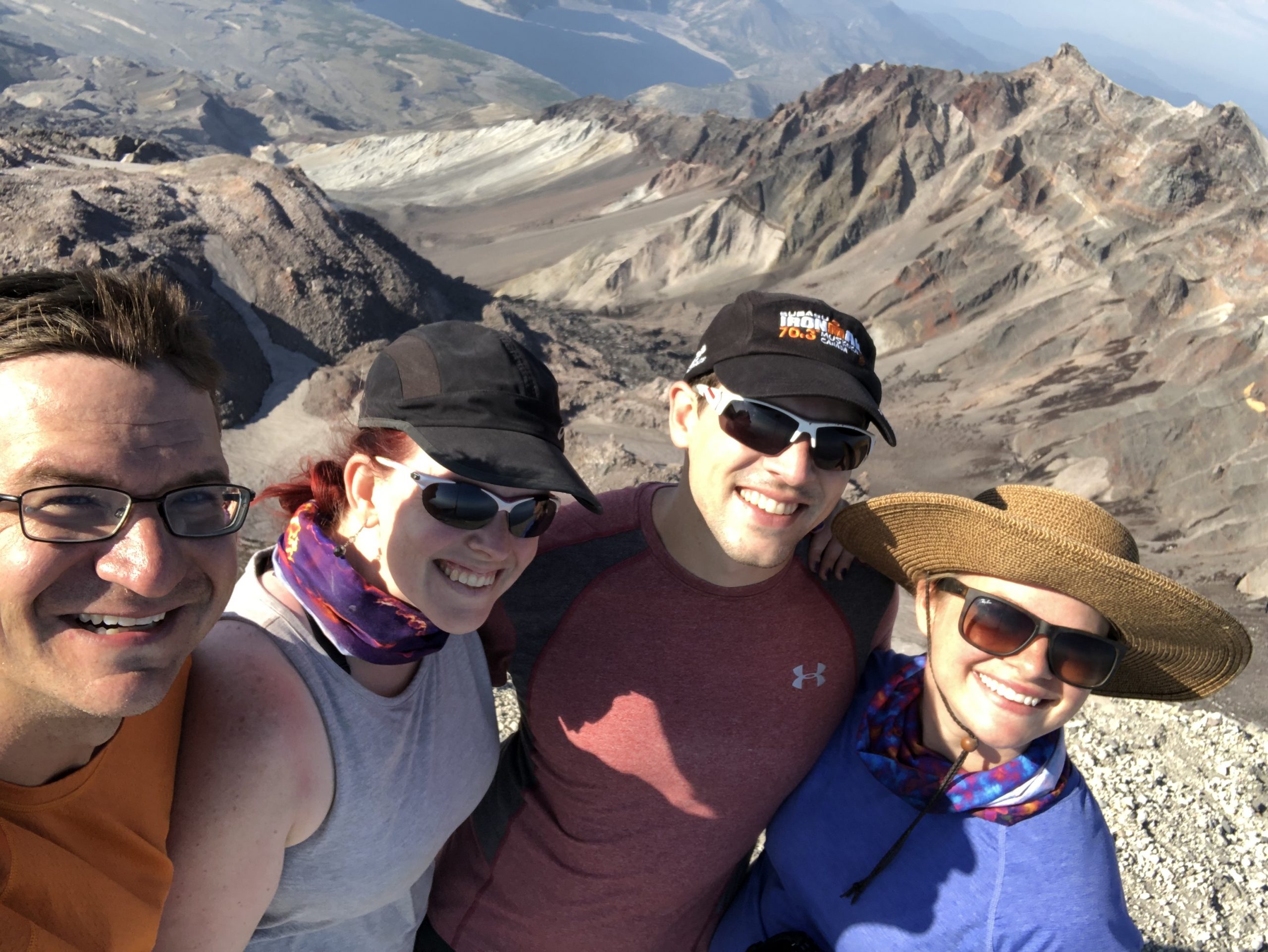
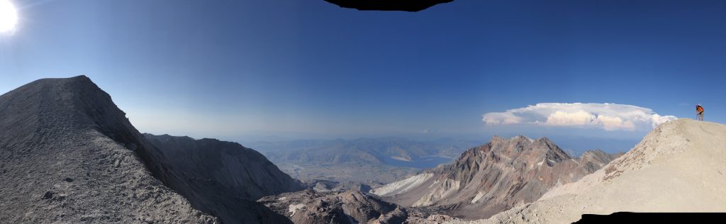
Three steps. Two. One. Suddenly, Mount St. Helens’ summit crater stretched wide open in front of me. The rim of the crater curved around to the north like eagles’ wings. An enormous lava dome that dwarfed everything around it sat perched in the heart of the mile-wide crater. The lava dome itself sat steaming happily away, tendrils of the white steam curling up toward us. The sharp scent of sulfur – like rotten eggs – made my nose sting.
We had made it! I clung to my husband, brother, and sister as we cried victorious tears. Jason, Paul, and Alex had each been overwhelmingly patient and kind to me on that hike. Twenty-four hours before, none of us imagined we’d be standing there together. But there we were! Successful because of each other’s patience, love for each other and for the volcano, and because of God’s grace.
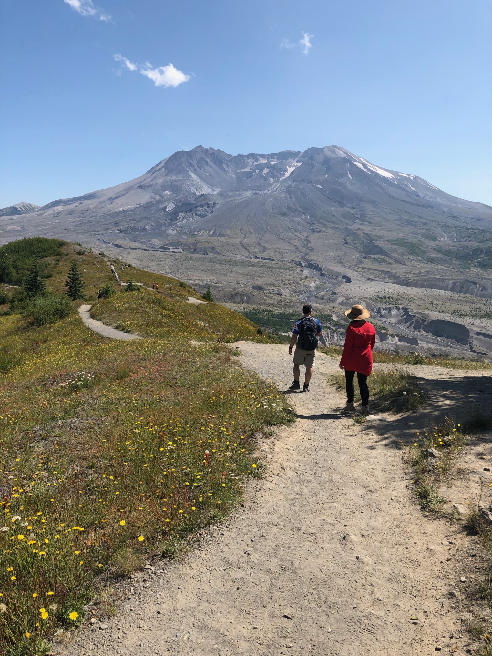
Mount St. Helens: The Boundary Trail
The landscape around Mount St. Helens is just packed with trails waiting to be explored. I’m certain I just need to move up to Washington for six months so that I can get my boots on every single one! My partners in crime and I had made it to the Johnston Ridge Observatory on the first leg of our trip. Spying the Boundary Trail running right past the Observatory, it was only logical that we grab our bags and set out on a hike. A short 6-miler sounded like the perfect warmup for the summit attempt we would be making in two days. All geared up, we struck out on Mount St. Helens’ Boundary Trail east toward Harry’s Ridge.
Mount St. Helens – A Trip Through Time
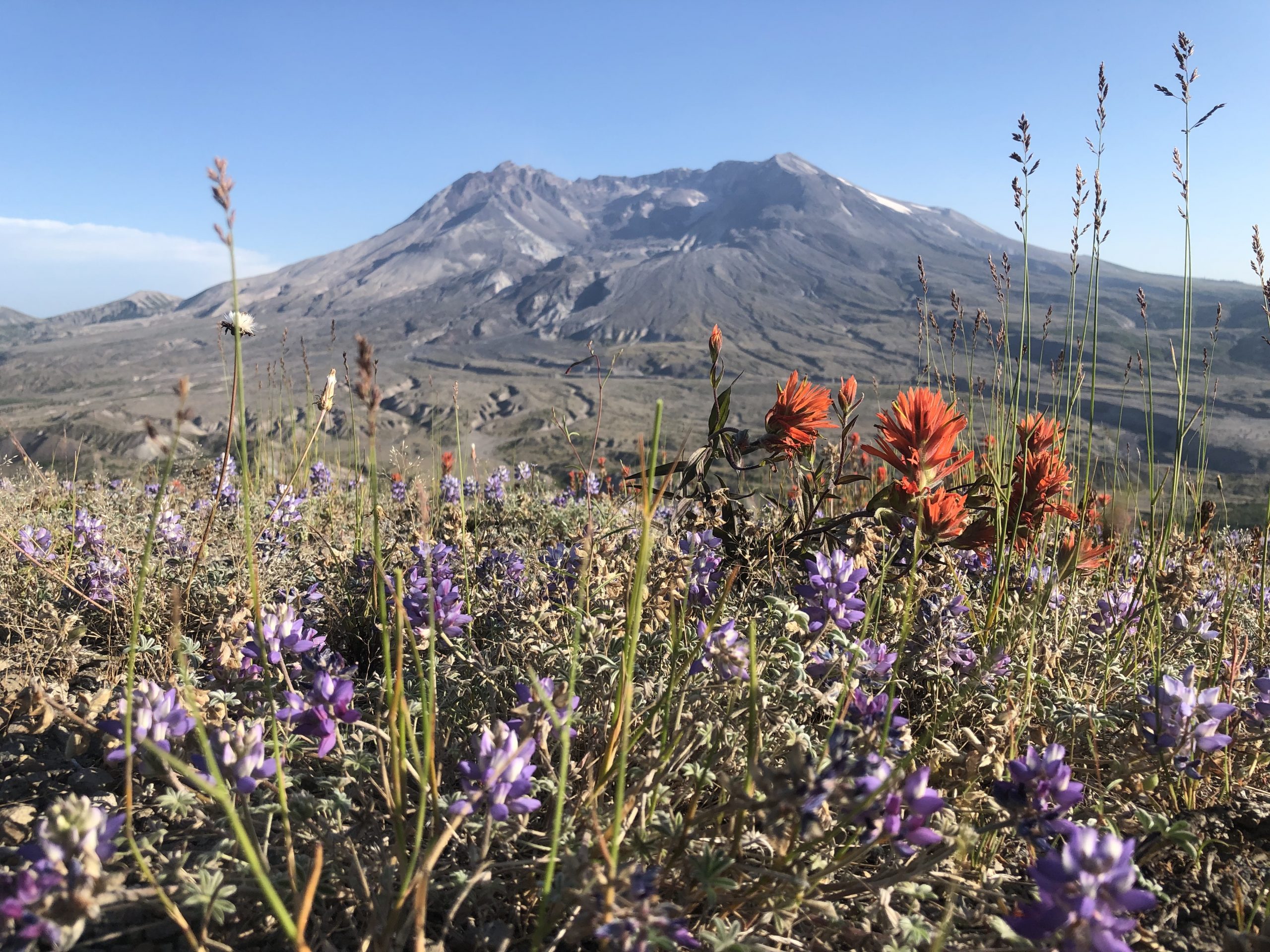
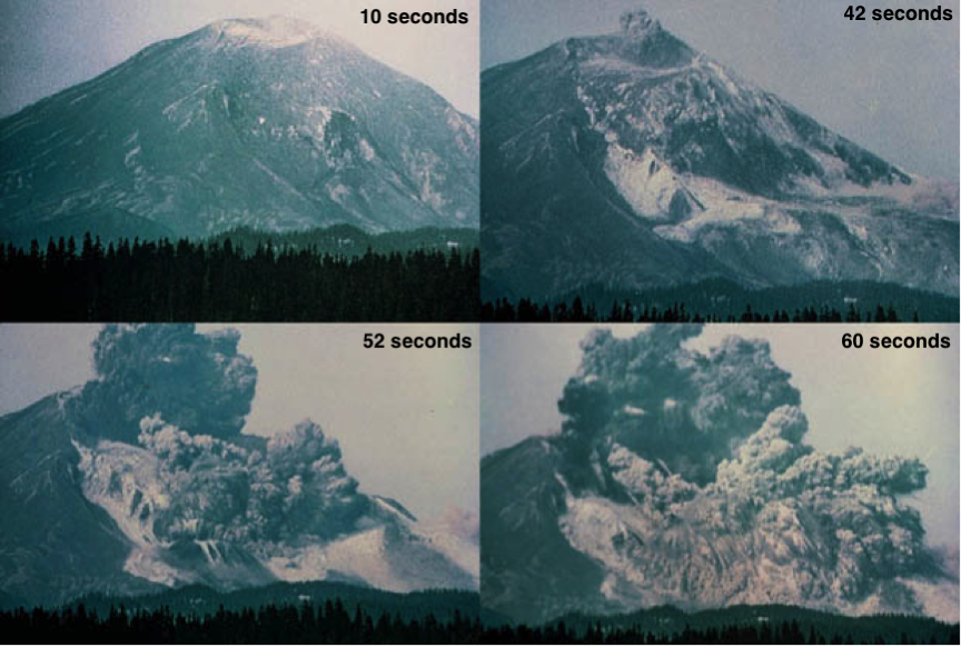
Mount St. Helens. Say her name and it instantly draws to mind images of the cataclysmic eruption of 1980. We all remember the news footage and heart-stopping images of the fiery blast. Americans as far away as Florida had at least a dusting of ash on their cars. Fifty-seven people lost their lives, and the infamous eruption’s impact has lasted to this day. Mount St. Helens has erupted before and since 1980, and has quite the track record to explore. So before we head out on our adventures with the volcano, let’s go on a whirlwind trip through time to get a better understanding of Mount St. Helens.
Capulin: The Summit
VITAL STATS
Name: Capulin
Type: Cinder Cone
Eruption Status: Extinct
Last Eruption: Approximately 60,000 years ago
Location: 36.7811° N, 103.9695° W
Northeastern New Mexico; Raton-Clayton Volcanic Field
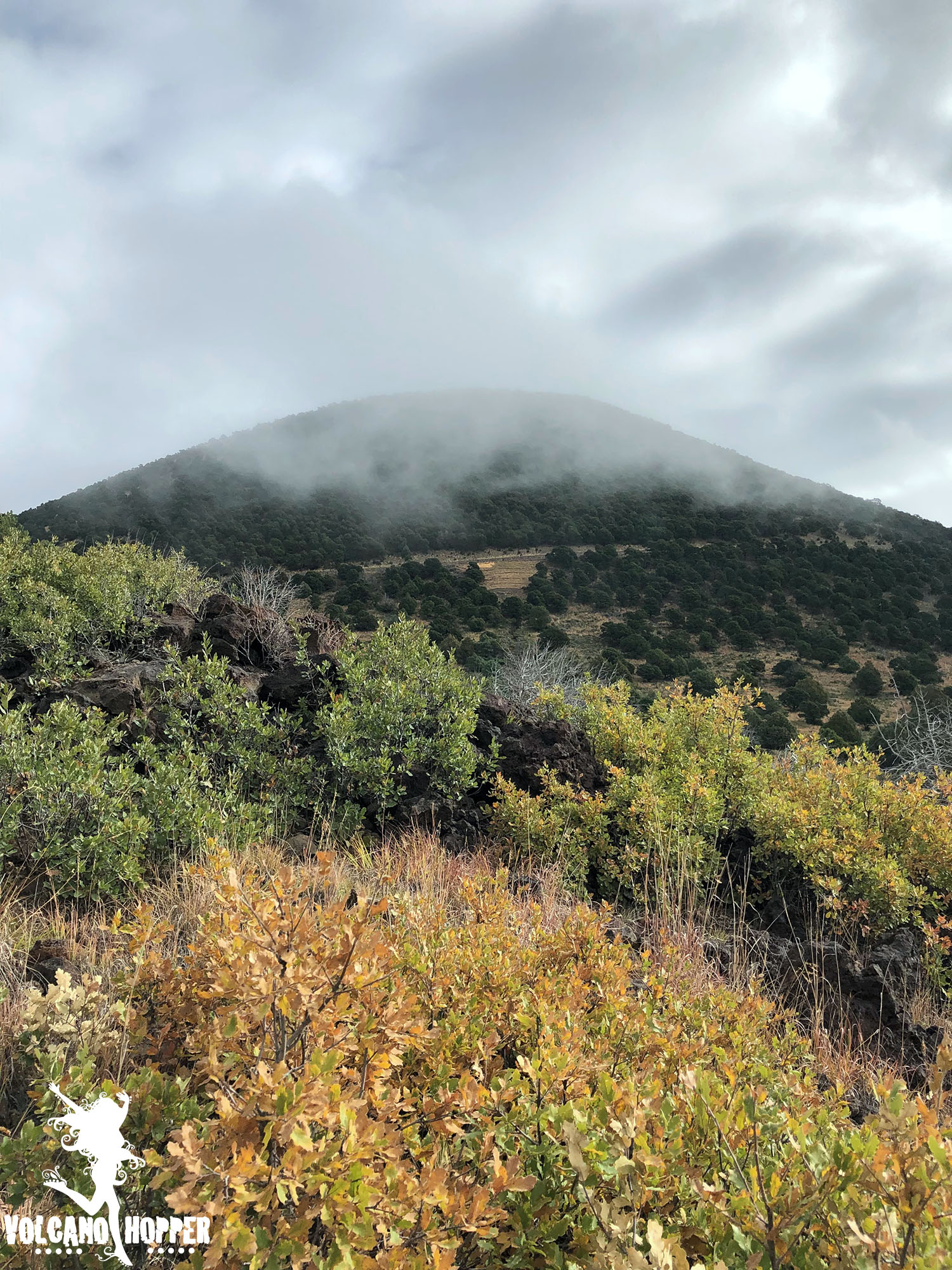
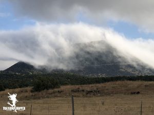
The clouds that enshrouded Capulin’s cone finally began to break around mid-morning. We raced to the summit to see what had been hidden behind the thick mist all morning. What we found was breathtaking.
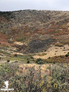
Capulin’s summit crater is perched over 1,300 feet above the surrounding plains, and the drive to reach it is nothing short of intimidating. If you’re not driving, take a peek out the passenger side window. There are no guardrails and the view is straight down. This cone has virtually no slope. Not intimidating…not at all…
Capulin: The Lava Flow Trail
Vital Stats
Name: Capulin
Type: Cinder Cone
Eruption Status: Extinct
Last Eruption: Approximately 60,000 years ago
Location: 36.7811° N, 103.9695° W
Northeastern New Mexico; Raton-Clayton Volcanic Field
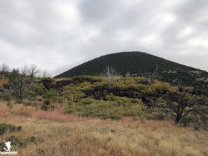
Capulin volcano has 4 lava flows – three of which are absolutely massive. They each started from a vent at the base of the volcano, which has left the stunning cone shape intact. As we waited for the clouds at the summit to lift, we decided to take a hop down the Lava Flow Trail.
This trail is a 1 mile loop through the second lava flow. It only scratches the surface; this flow extends over 2 miles down toward Highway 87! We were anxious to get our boots on the ground and go exploring. So off into the silent, misty morning we went.
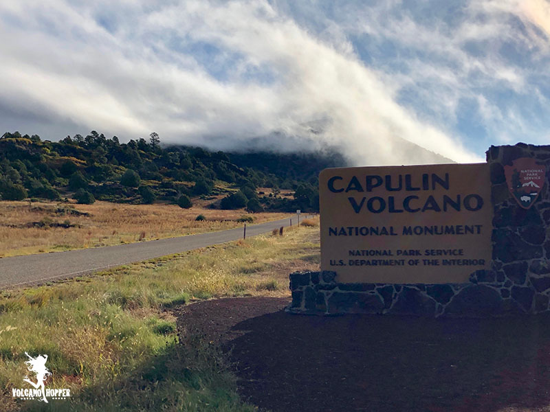
Capulin Volcano
Vital Stats
Name: Capulin
Type: Cinder Cone
Eruption Status: Extinct
Last Eruption: Approximately 60,000 years ago
Location: 36.7811° N, 103.9695° W
Northeastern New Mexico; Raton-Clayton Volcanic Field
The drive east through Northern New Mexico can be a pretty boring one. The landscape is flat and brown, minus a few hills popping up here and there. Major yawn factor – until you see the unmistakable cone of a volcano standing majestically next to the highway. And then you realize exactly what you’re driving through.
The Raton-Clayton Volcanic Field stretches from southern Colorado to the western border of Oklahoma and Texas, near the town of Clayton, NM. This volcanic field is a bit of an anomoly in the volcano world. Most volcanoes form on hot spots (like Hawaii) or along plate boundaries (Cascade Range). New Mexico doesn’t sit on either one. However, a continental rift does run though the area where the land is pulling apart and much thinner than the surrounding crust. This is what allowed magma to rise to the surface, creating some spectacular volcanic activity.
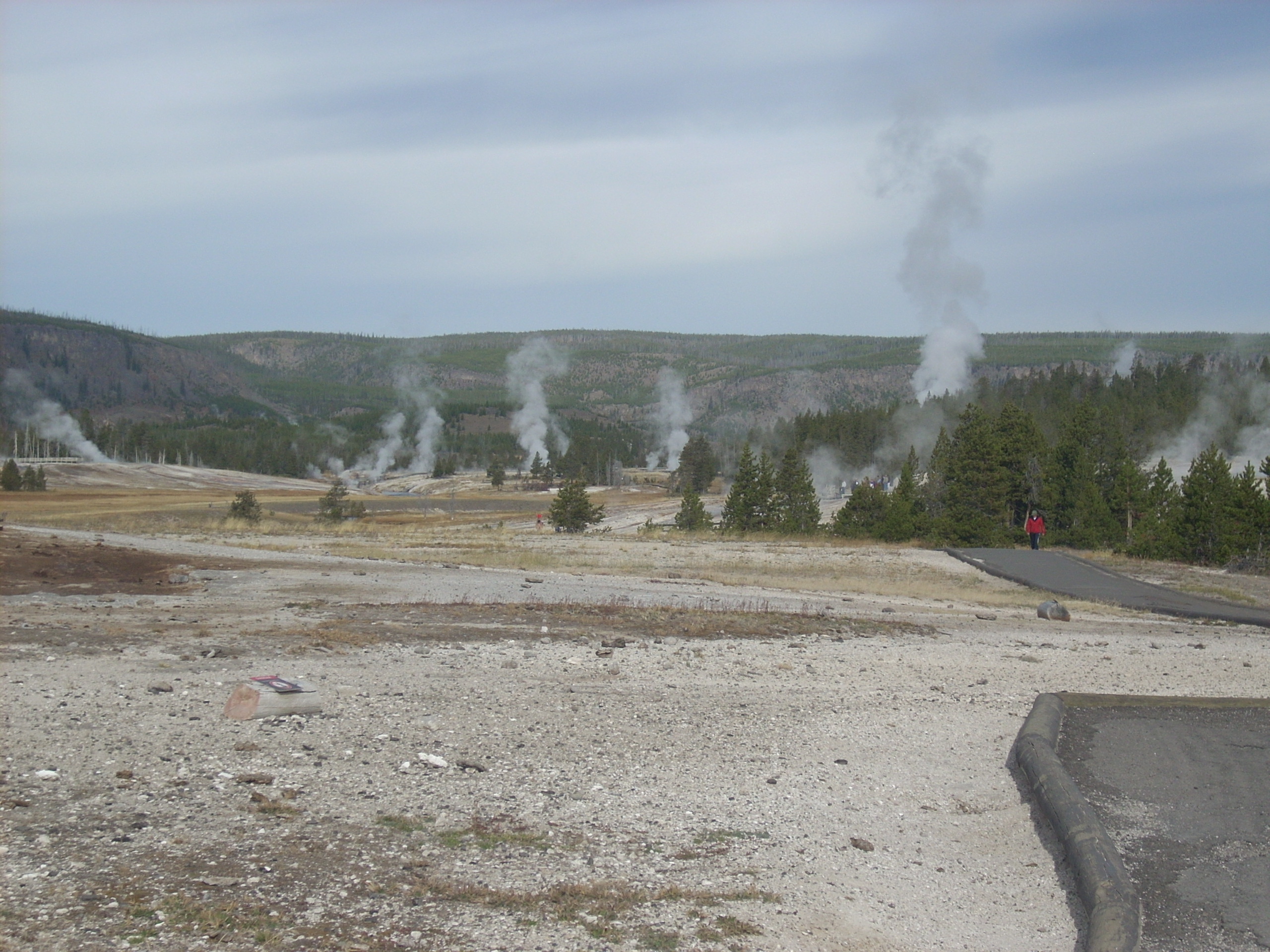
The Day Yellowstone Erupted…
I promised you in the last post that we’d get to look at what would happen if Yellowstone Volcano really did erupt. Not necessarily a fun thing to imagine, and let’s hope it never does happen. So, sit back with a warm drink and let’s imagine what would happen if Yellowstone Volcano did decide to erupt with full force. Here we go…
It’s official. It’s gonna be a bad Monday.
News nowadays usually travels faster than you can blink. Too bad some things travel just slightly faster.
It’s the middle of July and I look out my office window to see dark clouds pouring over the Colorado mountains. Flakes of snow are raining down. Huge flakes that blanket everything. And they are a mucky gray.