
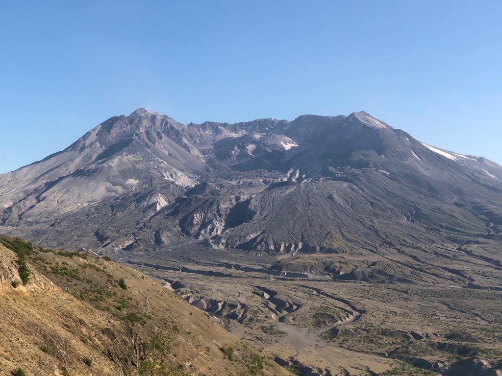
The View From Mount St. Helens’ Summit
This year marks the 40th anniversary of the May 18, 1980 eruption at Mount St. Helens. Just a few months shy of the anniversary, we climbed the volcano to check out the views from Mount St. Helens’ summit. We could clearly see and smell the steaming lava dome, witnessed rockfalls…
Fearless Footsteps
I am super excited to announce that Intrepid Times and Exisle Publishing are releasing an amazing anthology called “Fearless Footsteps” next year – and that our story about climbing Mount St. Helens will be featured in it! Copyright © 2019 Volcano Hopper. All rights reserved. Loved this post? Share it!
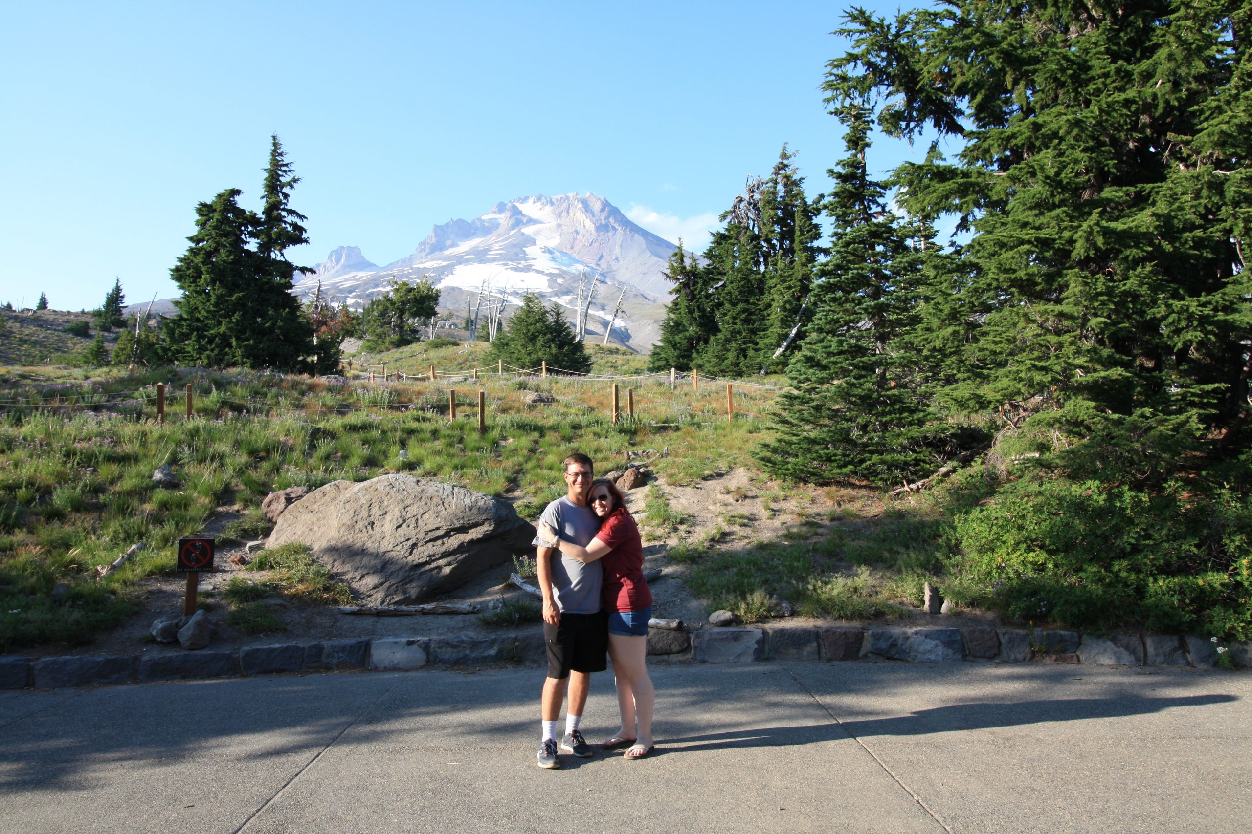
Mount Hood
Wy’east has a secret. He loves the sunrise.
Before the sun even rose, I felt the stirring. I lifted my head from the soft pillow and looked out the window. Outside of our log cabin at the base of Mount Hood, the sky was turning purple behind the thick cluster of trees. Streaks of pink began to tint the clouds, then orange strands began to glow. But there was something else in the air that morning that I’d never quite felt before during a sunrise. It was like the quivering excitement you felt as a kid on Christmas morning. It grows and grows until you burst from your bed and race downstairs to see the presents under the tree.
I snuggled under the thick down comforter as I watched the sunrise. The excitement thickened in the air like static electricity. Jason was fast asleep next to me. And I hadn’t heard a peep from downstairs. Even the birds had barely begun to chirp. The only one up was the volcano.
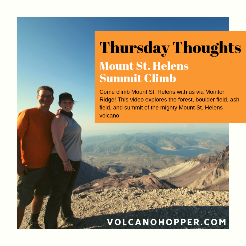
Thursday Thoughts – Climbing Mount St. Helens
Climbing Mount St. Helens was one of the most difficult, and most rewarding, hikes I have ever done. There is nothing quite like the thrill of reaching the top of an active volcano!
Mount St. Helens: Scaling the Volcano
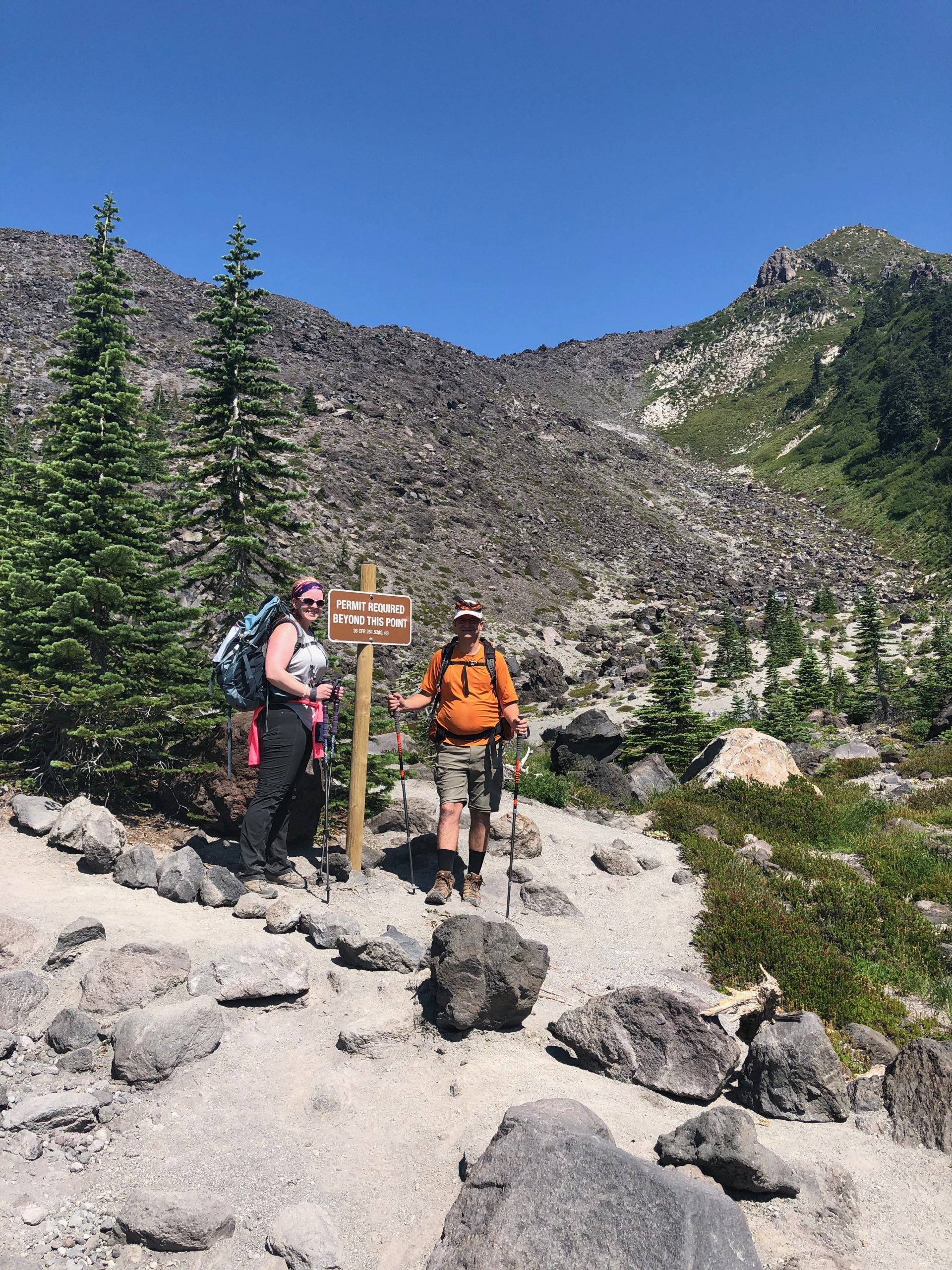
Monitor Ridge – Part 1
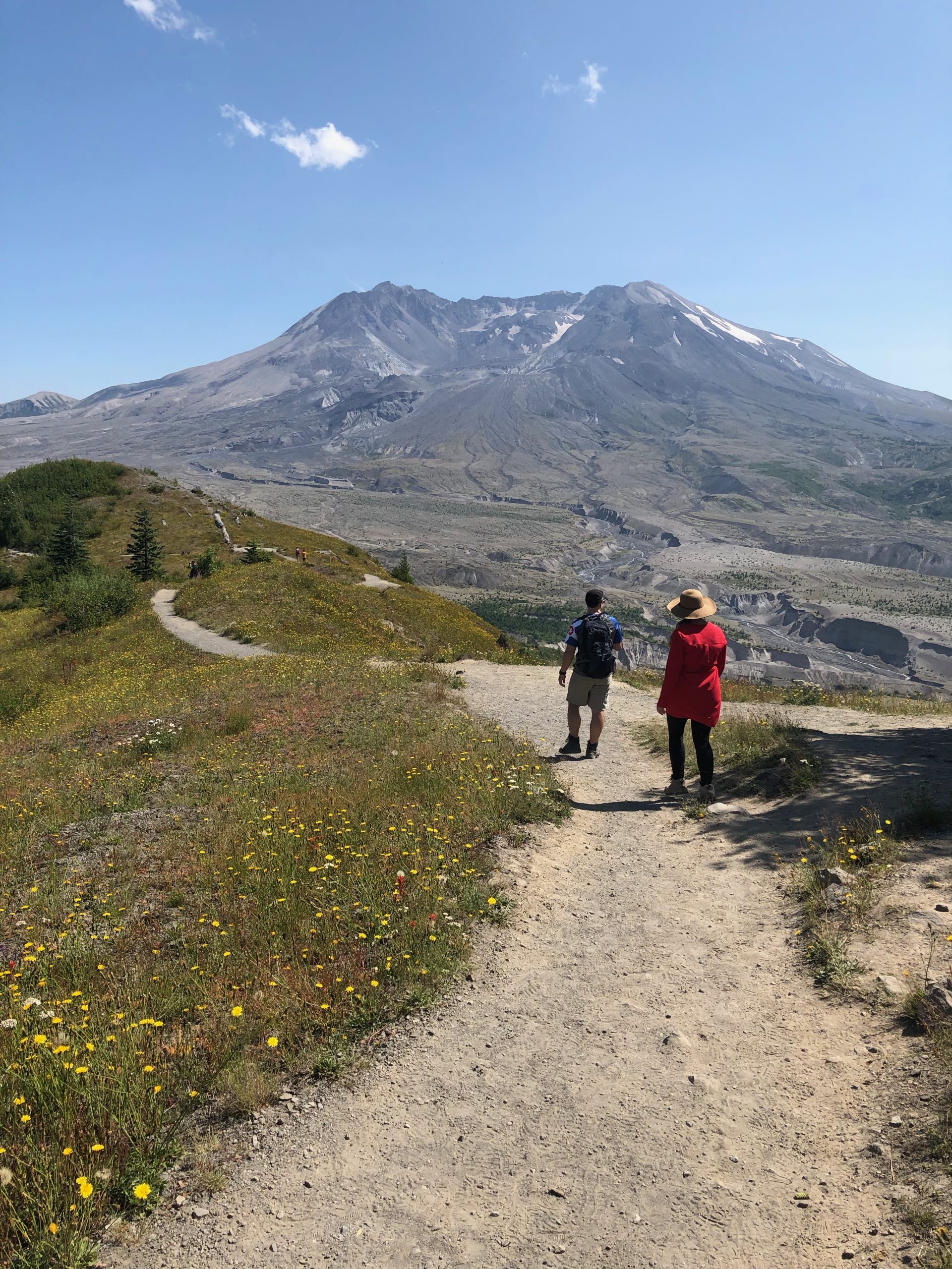
Mount St. Helens is 8,366’ of badass stratovolcano. She may not be the tallest volcano out there, but her slopes are steep and slippery. And did I mention that she’s active? At any moment, the volcano could hiccup and cause an ash explosion, pyroclastic flow, rockfall, or landslide. So, naturally, I wanted to climb to the very top!
If you’d have told me as a kid, watching the eruption footage, that I’d ever have the opportunity to climb to Mount St. Helens’ summit, I never would have believed it. But on a sunny Tuesday in August, that was exactly what I was planning to do.
Mount St. Helens: The Boundary Trail
The landscape around Mount St. Helens is just packed with trails waiting to be explored. I’m certain I just need to move up to Washington for six months so that I can get my boots on every single one! My partners in crime and I had made it to the Johnston Ridge Observatory on the first leg of our trip. Spying the Boundary Trail running right past the Observatory, it was only logical that we grab our bags and set out on a hike. A short 6-miler sounded like the perfect warmup for the summit attempt we would be making in two days. All geared up, we struck out on Mount St. Helens’ Boundary Trail east toward Harry’s Ridge.
Capulin: The Summit
VITAL STATS
Name: Capulin
Type: Cinder Cone
Eruption Status: Extinct
Last Eruption: Approximately 60,000 years ago
Location: 36.7811° N, 103.9695° W
Northeastern New Mexico; Raton-Clayton Volcanic Field
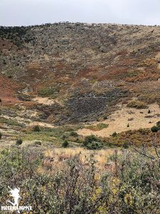
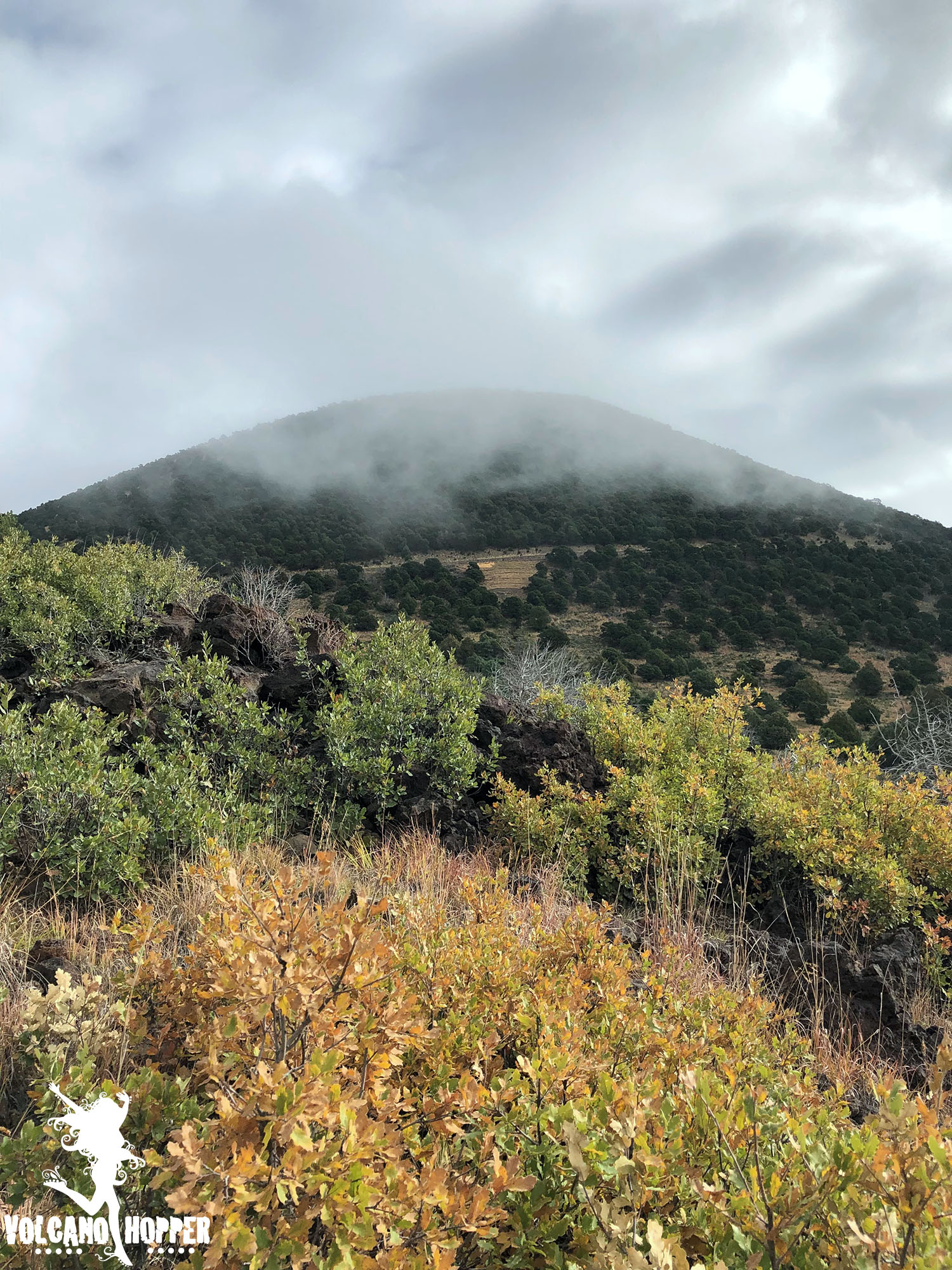
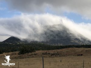
The clouds that enshrouded Capulin’s cone finally began to break around mid-morning. We raced to the summit to see what had been hidden behind the thick mist all morning. What we found was breathtaking.
Capulin’s summit crater is perched over 1,300 feet above the surrounding plains, and the drive to reach it is nothing short of intimidating. If you’re not driving, take a peek out the passenger side window. There are no guardrails and the view is straight down. This cone has virtually no slope. Not intimidating…not at all…
Capulin: The Lava Flow Trail
Vital Stats
Name: Capulin
Type: Cinder Cone
Eruption Status: Extinct
Last Eruption: Approximately 60,000 years ago
Location: 36.7811° N, 103.9695° W
Northeastern New Mexico; Raton-Clayton Volcanic Field
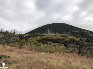
Capulin volcano has 4 lava flows – three of which are absolutely massive. They each started from a vent at the base of the volcano, which has left the stunning cone shape intact. As we waited for the clouds at the summit to lift, we decided to take a hop down the Lava Flow Trail.
This trail is a 1 mile loop through the second lava flow. It only scratches the surface; this flow extends over 2 miles down toward Highway 87! We were anxious to get our boots on the ground and go exploring. So off into the silent, misty morning we went.
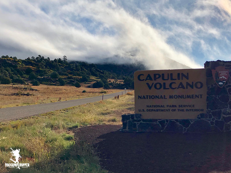
Capulin Volcano
Vital Stats
Name: Capulin
Type: Cinder Cone
Eruption Status: Extinct
Last Eruption: Approximately 60,000 years ago
Location: 36.7811° N, 103.9695° W
Northeastern New Mexico; Raton-Clayton Volcanic Field
The drive east through Northern New Mexico can be a pretty boring one. The landscape is flat and brown, minus a few hills popping up here and there. Major yawn factor – until you see the unmistakable cone of a volcano standing majestically next to the highway. And then you realize exactly what you’re driving through.
The Raton-Clayton Volcanic Field stretches from southern Colorado to the western border of Oklahoma and Texas, near the town of Clayton, NM. This volcanic field is a bit of an anomoly in the volcano world. Most volcanoes form on hot spots (like Hawaii) or along plate boundaries (Cascade Range). New Mexico doesn’t sit on either one. However, a continental rift does run though the area where the land is pulling apart and much thinner than the surrounding crust. This is what allowed magma to rise to the surface, creating some spectacular volcanic activity.